Mira River (Nova Scotia) facts for kids
Quick facts for kids Mira |
|
|---|---|

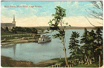
The Mira Ferry once served on the Mira River.
|
|
|
Mira River in Nova Scotia
|
|
| Native name | Sookakade |
| Country | Canada |
| Province | Nova Scotia |
| Physical characteristics | |
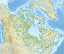
| River mouth | Mira Gut sea level 46°2′10″N 59°58′8″W / 46.03611°N 59.96889°W |
| Length | 54 km (34 mi) |
| Basin features | |
| Progression | Mira Gut—Mira Bay |
| Basin size | 2,914 km2 (1,125 sq mi) (together with Salmon River) |
| Bridges | Victoria Bridge, Marion Bridge, Albert Bridge, Mira Gut Bridge (demolished) |
The Mira River (pronounced like "Myra") is a river in Canada. You can find it in eastern Cape Breton Island, Nova Scotia.
The Mira River is about 55 km (34 mi) long. It flows very slowly, winding its way through the land. The river starts from several lakes near Victoria Bridge. It also gets water from the Salmon River.
As it flows, the Mira River passes by towns like Marion Bridge and Albert Bridge. Finally, it empties into the "Mira Gut" and then into Mira Bay. The river follows a long path from southwest to northeast across southern Cape Breton County. The eastern part of the river is an estuary, which means it's where the river meets the ocean. You can even notice the ocean's tides far up the river, past Albert Bridge!
Contents
What's in a Name?
The Mi'kmaq people, who are the original inhabitants of this land, called the river 'Sookakade.' This name means 'the silver-place.'
One story says the river was named after a French officer, Lieutenant M. de Mire, in 1746. Another idea is that Portuguese fishermen and explorers named it after a place in Portugal. By 1776, maps showed the name as 'Miray' or 'Mire.'
How the Mira River Was Formed
The Mira River Valley is a very important natural feature in southeastern Cape Breton. It stretches from Framboise Cove north to Marion Bridge, then turns east towards Mira Bay.
The river flows between very old rock formations. To the north, there are rocks from the Carboniferous period, about 320 million years old. To the south, there are rocks from the Cambrian and Precambrian periods, about 500 million years old. A thick layer of sand and gravel covers these ancient rocks. This layer was left behind when the last ice age ended about 15,000 years ago.
The river lies in a long, narrow valley. The lower parts of the river were blocked by glacial gravels, forming a long lake-like area. These glacial deposits also created many peninsulas, like the one where Mira River Provincial Park is located. Close to its mouth, the Mira River cuts through bedrock to reach the Atlantic Ocean.
Ancient Forests and Fossils
The Carboniferous rocks north of the Mira River contain many coal seams. These seams are proof that the area was once covered by shallow lakes, swamps, and coastal flood plains about 300 million years ago. You can find many fossils in this coal, which tells us about the plants and animals that lived there long ago. These coal seams were important for the region's history of coal mining. South of the Mira, you can also find fossils in the Cambrian sandstones and shales.
Life in the Mira River
The Mira River and its connected waterways cover an area of about 648 square kilometres (250 sq mi). Its main smaller rivers are the Gaspereau, Salmon, and Trout rivers, along with Black Brook. In the southern part of the river, glacial deposits have created a chain of small lakes, all close to sea level. The ocean's tides cause the water to move back and forth in the eastern part of the river.
The waters of the Mira River are home to many different kinds of fish. These include sea trout, shad, perch, American eel, striped bass, mackerel, herring, brook trout, speckled trout, minnows, and smelt. Because of all these fish, the river is a popular spot for fishing!
Fun on the Mira River
The Mira River is wide and its waters are usually calm. This makes it a great place for boating and other fun activities. Many cottages are built along its banks.
Several campgrounds and parks, along with the Mira Boat Club at Albert Bridge, make the Mira River a popular vacation spot in the Cape Breton Regional Municipality. Some popular places for swimming include Marion Bridge, Mira Gut Beach, Sangaree Island, Mira Water Park, and Albert Bridge.
The Mira area is also home to the Two Rivers Wildlife Park. In 2011, about 102,428 people lived in the Mira/Salmon River watershed area.
Bridges Over the Mira

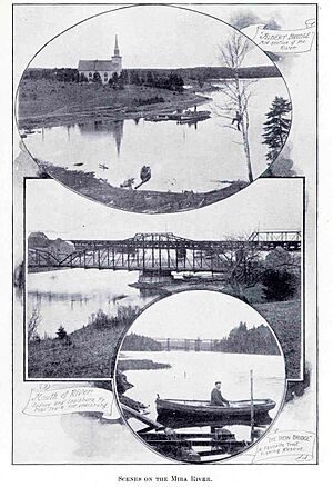
Today, three road bridges cross the Mira River. These are the Victoria Bridge, the Marion Bridge, and the Albert Bridge. Each bridge is in the community it's named after. Over the years, there have been other bridges for roads or trains.
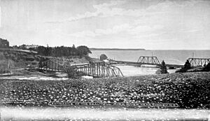
For over 140 years, the mouth of the river was crossed by the Mira Gut Bridge. This was a swing bridge, meaning its middle part could turn to let boats pass. It was first built for the Sydney and Louisburg Railway. Later, it was changed to carry Mira Bay Drive. The bridge became unsafe and was taken down in November 2017. Officials are now looking into ways to replace it.
The Mira Gut Bridge and the Albert Bridge were once popular spots for young people to jump into the water. This activity is not as common now. This is due to concerns about safety and the possibility of fines. The Gut bridge was used because of the strong currents there. Albert Bridge was used because it was high above the water and had a deep pool below it.
 | John T. Biggers |
 | Thomas Blackshear |
 | Mark Bradford |
 | Beverly Buchanan |


