Mirpur Thana facts for kids
Quick facts for kids
Mirpur
মীরপুর (মিরপুর)
|
|
|---|---|

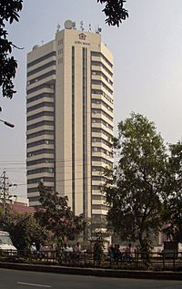
A picture of Grameen Bank situated in Mirpur, Bangladesh
|
|
| Country | |
| Division | Dhaka Division |
| District | Dhaka District |
| Area | |
| • Total | 58.66 km2 (22.65 sq mi) |
| Population
(2007)
|
|
| • Total | 1,074,232 |
| • Density | 16,838/km2 (43,610/sq mi) |
| Time zone | UTC+6 (BST) |
| Postal Code |
1216
|
| Website | Official Map of the Mirpur Thana: http://www.bangladesh.gov.bd/maps/images/dhaka/MirpurT.gif |
Mirpur (Bengali: মীরপুর/মিরপুর) is a very important and busy area in Dhaka city, Bangladesh. It is known as a thana, which is like a special administrative zone or sub-district. Mirpur is a lively place with many people and interesting sights.
Mirpur: A Lively Part of Dhaka
Mirpur is a large and well-known part of Dhaka, the capital city of Bangladesh. It is home to over a million people, making it a very crowded and active area. Many different types of neighborhoods and businesses can be found here.
Where is Mirpur?
Mirpur is located in the northern part of Dhaka city. You can find it on a map at these special coordinates: 23.8042° N (North) and 90.3667° E (East). This helps people pinpoint its exact location anywhere in the world.
The area of Mirpur covers about 58 square kilometers. This makes it quite a large section of the city. It is situated to the north-east of the main Dhaka city center.
What is a Thana?
In Bangladesh, a "thana" is a type of administrative division. It is similar to a sub-district or a police station area. This means Mirpur has its own local government and services. These services help manage the area and its large population.
Images for kids
 | James Van Der Zee |
 | Alma Thomas |
 | Ellis Wilson |
 | Margaret Taylor-Burroughs |


