Mistake Peak (Arizona) facts for kids
Quick facts for kids Mistake Peak |
|
|---|---|
| Highest point | |
| Elevation | 5,930 ft (1,807 m) NGVD 29 |
| Prominence | 39 metres (128 ft) |
| Geography | |
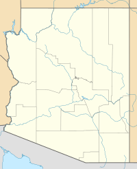
| Location | Gila County, Arizona, U.S. |
| Parent range | Sierra Ancha |
| Topo map | USGS Picture Mountain |
Mistake Peak is a mountain peak located in Gila County, in the state of Arizona in the United States. It stands at an elevation of 5,930 feet (about 1,807 meters) above sea level. This makes it a notable point in the Sierra Ancha mountain range.
What is Mistake Peak?
Mistake Peak is a specific point on a mountain, known as a summit. It is found in the central part of Arizona. The peak is part of the larger Sierra Ancha mountain range, which is known for its rugged and beautiful landscapes.
How High is Mistake Peak?
The top of Mistake Peak reaches an elevation of 5,930 feet. This measurement tells us how high the peak is compared to the level of the sea. While it might not be the tallest mountain in Arizona, it is still a significant natural landmark in its area.
Why is it Called Mistake Peak?
The name "Mistake Peak" is quite unusual and interesting! It is believed that the peak got its name because early land surveyors made a mistake. They might have thought this peak was another, different summit. When they realized their error, the name "Mistake Peak" stuck. This makes it one of many places in the United States with a very unique or funny name.
 | John T. Biggers |
 | Thomas Blackshear |
 | Mark Bradford |
 | Beverly Buchanan |


