Mistaya River facts for kids
Quick facts for kids Mistaya River |
|
|---|---|

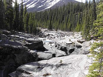
Mistaya River before the falls
|
|
| Country | Canada |
| Province | Alberta |
| Physical characteristics | |
| Main source | Peyto Lake |
| Length | 38 km (24 mi) |
| Basin features | |
| River system | North Saskatchewan River |
The Mistaya River is a short but beautiful river in western Alberta, Canada. It flows through the amazing Canadian Rockies, which are tall, rugged mountains. A famous road called the Icefields Parkway follows part of its path.
Contents
Where the Mistaya River Starts
The Mistaya River begins in Peyto Lake. This lake is known for its bright, milky blue color. It's a glacial lake, which means it gets its water from melting glaciers. The blue color comes from tiny rock particles, called rock flour, that glaciers grind up.
Journey Through the Mountains
As the Mistaya River flows, it travels northwest. It collects water from several smaller streams and creeks along the way. The river also forms a couple of long, narrow lakes, including Mistaya Lake and Waterfowl Lakes. These lakes are popular spots for visitors.
The river's journey ends when it joins the larger North Saskatchewan River. This meeting point is near a place called Saskatchewan River Crossing.
How Long is the Mistaya River?
From its very beginning at Peyto Creek, the Mistaya River flows for about 38 kilometers (or 24 miles). That's like driving for about half an hour!
What Does "Mistaya" Mean?
The name "Mistaya" comes from the Cree language. The Cree are one of the largest groups of First Nations people in Canada. In their language, ᒥᐢᑕᐦᐊᔭ (pronounced mistahaya) means "grizzly bear". This shows how important these powerful animals are to the region.
 | Bayard Rustin |
 | Jeannette Carter |
 | Jeremiah A. Brown |

