Moctezuma River facts for kids
Quick facts for kids Moctezuma River |
|
|---|---|
 |
|
| Country | Mexico |
| Physical characteristics | |
| River mouth | Pánuco River 21°58′03″N 98°33′47″W / 21.96750°N 98.56306°W |
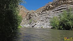
The Moctezuma River (also called Río Moctezuma in Spanish) is an important river in Mexico. It helps drain the eastern part of a large mountain range called the Trans-Mexican Volcanic Belt. This river is a major branch of the Pánuco River. It flows through several Mexican states, including Hidalgo, Querétaro, and San Luis Potosí.
Where the Moctezuma River Flows
The Moctezuma River begins at the Zimapán Dam. This dam creates a large lake where two other rivers, the Tula River and the San Juan River, meet. After they join in the dam's reservoir, they form the Moctezuma River further downstream.
The Zimapán Dam is a hydroelectric dam. This means it uses the power of water to create electricity. It is located about 15 kilometers (about 9 miles) southwest of the town of Zimapán.
As the Moctezuma River continues its journey, it meets other rivers. Near the town of Tamazunchale, it receives water from the Amajac River. Further along, below the town of Tanquián de Escobedo, the Moctezuma River forms a natural border. It separates the states of San Luis Potosí and Veracruz.
The river then receives the Tempoal River near El Higo. Finally, the Moctezuma River ends when it joins with the Tamuín River (also known as the Tampaón River). Together, these two rivers then form the larger Pánuco River.
See also
 In Spanish: Río Moctezuma para niños
- Tributaries of the Pánuco River
- List of rivers of Mexico
 | Percy Lavon Julian |
 | Katherine Johnson |
 | George Washington Carver |
 | Annie Easley |

