
Moculta, South Australia facts for kids
Quick facts for kids MocultaSouth Australia |
|||||||||||||||
|---|---|---|---|---|---|---|---|---|---|---|---|---|---|---|---|

Gnadenberg Church and the Hill of Grace wineyard
|
|||||||||||||||

Moculta
Location in South Australia
|
|||||||||||||||
| Established | 1842 (sub-division) 15 May 2003 |
||||||||||||||
| Postcode(s) | 5353 | ||||||||||||||
| Time zone | ACST (UTC+9:30) | ||||||||||||||
| • Summer (DST) | ACST (UTC+10:30) | ||||||||||||||
| Location |
|
||||||||||||||
| LGA(s) | Barossa Council | ||||||||||||||
| County | Light | ||||||||||||||
| State electorate(s) | Schubert | ||||||||||||||
| Federal Division(s) | Barker | ||||||||||||||
|
|||||||||||||||
|
|||||||||||||||
| Footnotes | Location Adjoining localities |
||||||||||||||
Moculta is a small place, or locality, in South Australia, Australia. It's about 69 kilometers (around 43 miles) north-east of Adelaide, the state's capital city. Moculta is also about 12 kilometers (about 7.5 miles) north-east of a town called Angaston. In 2016, Moculta and a part of Truro together had a population of 227 people.
Discovering Moculta
A Look Back in Time
The first people to settle in the Moculta area came from England, Scotland, and Ireland. Among these early settlers were two brothers, Abraham and David Shannon. Later, German families also moved to the area, starting from 1853. These German settlers built two important churches: the Gruenberg Lutheran Church in 1859 and the Gnadenberg Lutheran Church. The main part of Moculta, which is like a small town, was officially planned in 1865 and people started living there soon after.
Changing Names and Places
During World War I, there was a time when many Australian places with German names were changed. This happened because of the war. The locality of Grünberg was renamed to Karalta during this period. However, over time, its name was changed back to Gruenberg, but with an English spelling. Today, Gruenberg is part of Moculta and another nearby place called Penrice. The Gnadenberg area is also now included within Moculta.
Languages Spoken
In Moculta, people mainly speak English. Some people also speak a special kind of German called Barossa German. This unique language developed in the Barossa Valley area because of the German settlers who came here long ago.
Gallery
-
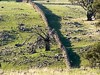
A dry stone wall at Mt Karinya near Moculta, South Australia.
-
A dry stone wall at Mt Karinya near Moculta, South Australia.
-
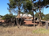
The restored cottage of the Rosenzweig's at Moculta, built circa 1859 with farm equipment in the foreground.
-
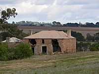
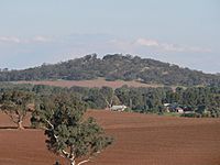
The ruins of the Shannon family's farmhouse at Moculta in 2006. The steeple of the Gruenberg Lutheran church can be seen in the background.
-
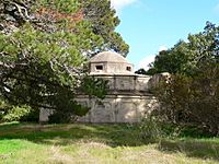
The Shannon family mausoleum outside of Moculta, South Australia.
-
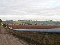
The Swan Reach to Stockwell Pipeline at Moculta, South Australia.


