
Moffat, Colorado facts for kids
Quick facts for kids
Moffat
|
|
|---|---|
| Town of Moffat, Colorado | |

A view of the town in winter, December 2012
|
|

Location of Moffat in Saguache County, Colorado.
|
|

Moffat
Location in Colorado

Moffat
Location in the United States
|
|
| Country | |
| State | |
| County | Saguache |
| Incorporated (town) | 1911 |
| Government | |
| • Type | Statutory town |
| Area | |
| • Total | 1.67 sq mi (4.31 km2) |
| • Land | 1.67 sq mi (4.31 km2) |
| • Water | 0.00 sq mi (0.00 km2) |
| Elevation | 7,566 ft (2,306 m) |
| Population
(2020)
|
|
| • Total | 108 |
| • Density | 64.7/sq mi (25.06/km2) |
| Time zone | UTC-7 (Mountain (MST)) |
| • Summer (DST) | UTC-6 (MDT) |
| ZIP code |
81143
|
| Area code(s) | 719 |
| FIPS code | 08-51250 |
| GNIS feature ID | 2413006 |
| Website | http://www.colorado.gov/townofmoffat |
The Town of Moffat is a small town located in Saguache County, Colorado, United States. It is known as a "statutory town," which means it follows specific rules set by the state of Colorado. In 2020, about 108 people called Moffat home.
Contents
About Moffat
Moffat is located in the beautiful state of Colorado. The town covers an area of about 4.31 square kilometers (1.67 square miles). All of this area is land, with no large bodies of water inside the town limits. Moffat sits at a high elevation of 7,566 feet (2,306 meters) above sea level.
A Look Back in Time
Moffat was started in 1890 by a group called the San Luis Town and Improvement Company. Many people came to live there in its early days. It became an important place for shipping cattle by train. The town was a major stop on the Denver and Rio Grande Western Railroad, which used a special "narrow gauge" track.
The town was named after David Moffat, who was an important official for the railroad.
Who Lives in Moffat?
| Historical population | |||
|---|---|---|---|
| Census | Pop. | %± | |
| 1940 | 149 | — | |
| 1950 | 109 | −26.8% | |
| 1960 | 104 | −4.6% | |
| 1970 | 98 | −5.8% | |
| 1980 | 105 | 7.1% | |
| 1990 | 99 | −5.7% | |
| 2000 | 114 | 15.2% | |
| 2010 | 116 | 1.8% | |
| 2020 | 108 | −6.9% | |
In 2000, there were 114 people living in Moffat. These people lived in 54 different households. About 22% of these households had children under 18 years old. Many households were made up of married couples.
The people in Moffat come from different backgrounds. About 15% of the population identified as Hispanic or Latino. The average age of people in Moffat in 2000 was 45 years old. This means half the people were younger than 45 and half were older.
Getting Around
Moffat is part of Colorado's public transportation system called Bustang. You can catch a bus from Moffat on the Alamosa-Pueblo Outrider line. This helps people travel to other towns and cities in the region.
Images for kids
-
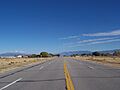
Colorado State Highway 17 looking north toward Moffat, October 2010

See also
 In Spanish: Moffat (Colorado) para niños
