Montaña Clara facts for kids

Montaña Clara Island
|
|
| Geography | |
|---|---|
| Coordinates | 29°17′56″N 13°32′06″W / 29.299°N 13.535°W |
| Archipelago | Chinijo Archipelago |
| Area | 1.33 km2 (0.51 sq mi) |
| Highest elevation | 256 m (840 ft) |
| Administration | |
| Autonomous Community | Canary Islands |
| Province | Las Palmas |
| Municipality | Teguise |
| Demographics | |
| Population | 0 (2013) |
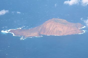
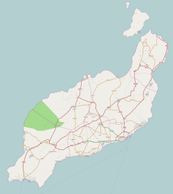
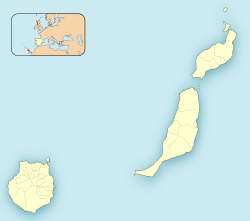
Montaña Clara is a small, uninhabited island in the Canary Islands, Spain. Its name means "light-colored mountain" in Spanish. This tiny island is part of a group of islands called the Chinijo Archipelago. It is located very close to another island called La Graciosa, only about 2 kilometers (1.2 miles) away.
About Montaña Clara
Montaña Clara is a very small island. Its total area is only 1.33 square kilometers (about half a square mile). The highest point on the island reaches 256 meters (840 feet) above the sea. This makes it a small but noticeable feature in the ocean.
A Special Place for Nature
This island is a very important place for nature. It is a safe haven, or "refuge," for many different kinds of marine birds. Because of its importance to wildlife, Montaña Clara is part of a protected area. It is part of the integral nature reserve called Los Islotes. This reserve is also a part of the larger Chinijo Archipelago natural park. These protections help keep the island and its wildlife safe.
A Bit of History
For a long time, Montaña Clara was owned by a family. In August 2007, the people who inherited the island decided to offer it for sale. The last owner was Mariano López Socas, who used to be a mayor in a small town on Lanzarote. The island was offered for 9 million euros.
See also
 In Spanish: Montaña Clara para niños
 | Bessie Coleman |
 | Spann Watson |
 | Jill E. Brown |
 | Sherman W. White |


