
Montferland facts for kids
Quick facts for kids
Montferland
|
|||
|---|---|---|---|

Looking towards the Montferland hills
|
|||
|
|||
.svg)
Location in Gelderland
|
|||
| Country | Netherlands | ||
| Province | Gelderland | ||
| Established | 1 January 2005 | ||
| Government | |||
| • Body | Municipal council | ||
| Area | |||
| • Total | 106.63 km2 (41.17 sq mi) | ||
| • Land | 105.68 km2 (40.80 sq mi) | ||
| • Water | 0.95 km2 (0.37 sq mi) | ||
| Elevation | 13 m (43 ft) | ||
| Highest elevation | 93 m (305 ft) | ||
| Population
(May 2014)
|
|||
| • Total | 35,059 | ||
| • Density | 332/km2 (860/sq mi) | ||
| Time zone | UTC+1 (CET) | ||
| • Summer (DST) | UTC+2 (CEST) | ||
| Postcode |
6940–6942, 7035–7048
|
||
| Area code | 0314, 0316 | ||


Montferland is a municipality in the Netherlands. It is located in the Gelderland province. A municipality is like a local government area. It was created on January 1, 2005. This happened when two older municipalities, Bergh and Didam, joined together.
Contents
Towns and Villages in Montferland
Montferland is made up of several towns and villages. These places were once part of the older municipalities.
Places from Bergh Municipality
- Azewijn
- Beek
- Braamt
- Kilder
- Lengel
- Loerbeek
- 's-Heerenberg
- Stokkum
- Vethuizen
- Wijnbergen
- Zeddam
Places from Didam Municipality
- Didam
- Greffelkamp
- Holthuizen
- Loil
- Nieuw-Dijk
- Oud-Dijk
Montferland in Pictures
-
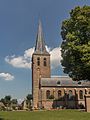
St Martin's church in Beek
-
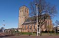
Didam church
-
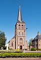
Kilder church
-
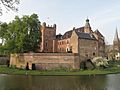
Huis Bergh castle in
's-Heerenberg -
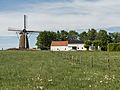
Düffels Möl in Stokkum
-
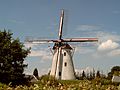
Windmill in Zeddam village


Famous People from Montferland

Many interesting people have come from Montferland. Here are a few:
- Willem IV van den Bergh (1537–1586) was a soldier and leader. He was born in 's-Heerenberg.
- Herman van den Bergh (1558–1611) was a Dutch soldier. He fought in the Eighty Years' War. He was also born in 's-Heerenberg.
- Mechteld ten Ham (died 1605) was a woman from 's-Heerenberg. She was accused of witchcraft in her time.
- Everard Ter Laak (1868–1931) was a Roman Catholic missionary. He worked in China and was born in Didam.
- Jozef Rulof (1898–1952) was a Dutch author. He was known as a psychic and trance medium. He was born in 's-Heerenberg.
- Jos Som (born 1951) is a Dutch politician. He was born in Didam.
- Ernie Brandts (born 1956) is a Dutch football manager. He was also a famous player. He was born in Nieuw-Dijk.
- Geert-Jan Derksen (born 1975) is a Dutch rower. He won a silver medal at the 2004 Summer Olympics. He was born in Didam.
See also
 In Spanish: Montferland (municipio) para niños

All content from Kiddle encyclopedia articles (including the article images and facts) can be freely used under Attribution-ShareAlike license, unless stated otherwise. Cite this article:
Montferland Facts for Kids. Kiddle Encyclopedia.