Montolieu facts for kids
Quick facts for kids
Montolieu
|
||
|---|---|---|

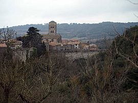
A general view of Montolieu
|
||
|
||
| Country | France | |
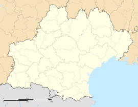
| Region | Occitanie | |
| Department | Aude | |
| Arrondissement | Carcassonne | |
| Canton | La Malepère à la Montagne Noire | |
| Area
1
|
23.65 km2 (9.13 sq mi) | |
| Population
(Jan. 2019)
|
836 | |
| • Density | 35.349/km2 (91.55/sq mi) | |
| Time zone | UTC+01:00 (CET) | |
| • Summer (DST) | UTC+02:00 (CEST) | |
| INSEE/Postal code |
11253 /11170
|
|
| Elevation | 123–407 m (404–1,335 ft) (avg. 200 m or 660 ft) |
|
| 1 French Land Register data, which excludes lakes, ponds, glaciers > 1 km2 (0.386 sq mi or 247 acres) and river estuaries. | ||
Montolieu is a charming small town, also known as a commune, located in the south of France. It's part of the beautiful Occitanie region and the Aude department. This lovely place is home to about 836 people, according to numbers from January 2019.
Contents
Discovering Montolieu
Montolieu is nestled in a scenic part of France. It sits in the Carcassonne area, which is famous for its history. The town is also part of the La Malepère à la Montagne Noire canton.
What is a Commune?
In France, a commune is like a local government area. It's the smallest division for how France is organized. Each commune has its own mayor and local council. They help manage things like local services and town planning.
Montolieu's Location and Size
Montolieu is situated at an elevation of about 200 meters (656 feet) above sea level. Its lowest point is 123 meters (404 feet), and its highest point reaches 407 meters (1,335 feet). The total area of the commune is about 23.65 square kilometers (9.13 square miles).
Local Leadership
Like all communes in France, Montolieu has a mayor who leads the local government. The mayor helps make decisions for the town and its people. From 2008 to 2014, the mayor of Montolieu was Edouard Ricard.
See also
 Learn more about Montolieu in Spanish: Montolieu para niños
 | Anna J. Cooper |
 | Mary McLeod Bethune |
 | Lillie Mae Bradford |


