Montpelier, Iowa facts for kids
Quick facts for kids
Montpelier, Iowa
|
|
|---|---|

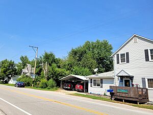
Montpelier, Iowa in 2023
|
|
| Country | United States |
| State | Iowa |
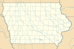
| County | Scott, Muscatine |
| Area | |
| • Total | 0.49 sq mi (1.27 km2) |
| • Land | 0.49 sq mi (1.27 km2) |
| • Water | 0.00 sq mi (0.00 km2) |
| Elevation | 568 ft (173 m) |
| Population
(2020)
|
|
| • Total | 186 |
| • Density | 379.59/sq mi (146.54/km2) |
| Time zone | UTC-6 (Central (CST)) |
| • Summer (DST) | UTC-5 (CDT) |
| ZIP code |
52759
|
| Area code(s) | 563 |
| FIPS code | 19-53715 |
| GNIS feature ID | 459197 |
Montpelier is a small community in Iowa, United States. It is located in Muscatine County. Montpelier is known as a census-designated place (CDP). This means it's an area identified by the U.S. Census Bureau for statistics. It does not have its own local government like a city. In 2020, about 186 people lived there. Montpelier is also part of the larger Muscatine area.
Contents
A Look Back: Montpelier's History
The very first people to settle in Muscatine County came from Vermont. They decided to name this new community "Montpelier." They chose the name after the capital city of their home state, Montpelier, Vermont.
Montpelier had a post office for many years. It was first opened on April 19, 1836, under the name "Iowa." On April 1, 1839, its name changed to Montpelier. The post office closed for a while in 1846. It reopened in 1882. However, it finally closed for good on February 18, 1986. After that, mail for Montpelier was handled by the Blue Grass post office. Even though it doesn't have its own post office anymore, Montpelier still has its own ZIP Code, which is 52759.
Where is Montpelier?
Montpelier is located along Iowa Highway 22. It sits right next to the Mississippi River. The community is about 13 miles east of Muscatine. Muscatine is the main city and county seat for Muscatine County. The city of Davenport is about 17 miles further up the river. Montpelier is about 568 feet above sea level.
The U.S. Census Bureau says that the Montpelier CDP covers an area of about 0.49 square miles. All of this area is land.
Who Lives in Montpelier?
Here's how Montpelier's population has changed over time:
| Historical population | |||
|---|---|---|---|
| Census | Pop. | %± | |
| 2020 | 186 | — | |
| U.S. Decennial Census | |||
Learning in Montpelier
The Muscatine Community School District runs the public schools that serve the Montpelier community. Students from Montpelier attend Muscatine High School.
 | Kyle Baker |
 | Joseph Yoakum |
 | Laura Wheeler Waring |
 | Henry Ossawa Tanner |


