
Mooers (CDP), New York facts for kids
Quick facts for kids
Mooers, New York
|
|
|---|---|

Downtown Mooers on US Route 11
|
|
_highlighted.svg)
Location in Clinton County and the state of New York.
|
|
| Country | United States |
| State | New York |
| County | Clinton |
| Town | Mooers |
| Incorporated | September 1899 |
| Dissolved | March 31, 1994 |
| Area | |
| • Total | 1.25 sq mi (3.25 km2) |
| • Land | 1.21 sq mi (3.14 km2) |
| • Water | 0.04 sq mi (0.11 km2) |
| Elevation | 282 ft (86 m) |
| Population
(2020)
|
|
| • Total | 451 |
| • Density | 371.50/sq mi (143.48/km2) |
| Time zone | UTC-5 (Eastern (EST)) |
| • Summer (DST) | UTC-4 (EDT) |
| ZIP code |
12958
|
| Area code(s) | 518 |
| FIPS code | 36-48241 |
| GNIS feature ID | 2389503 |
Mooers is a small community in Clinton County, New York, United States. It used to be called Mooers-upon-the-Chazy. Mooers is known as a hamlet and a census-designated place (CDP). A hamlet is a small settlement, and a CDP is an area the government defines for counting people.
Mooers is part of the larger town of Mooers. In 2020, about 451 people lived in the Mooers CDP. The entire town of Mooers had a population of 3,592 in 2010. Mooers was once an official village, but it stopped being one in 1994.
This community is in northern New York state. It is very close to the Canada–United States border with the Canadian province of Quebec.
Contents
Location and Landscape
Mooers is in the eastern part of the town of Mooers. It is about 3 miles (5 km) south of the border with Canada. The community is where two main roads meet: U.S. Route 11 and New York State Route 22. It sits on the north side of the Great Chazy River.
Getting Around Mooers
- U.S. Route 11 goes east about 6 miles (10 km) to Interstate 87 near the village of Champlain. It also goes west about 27 miles (43 km) to Chateaugay.
- New York State Route 22 goes south about 20 miles (32 km) to Plattsburgh. Plattsburgh is the main city and county seat for Clinton County.
Area Size
The Mooers CDP covers a total area of about 1.25 square miles (3.2 square kilometers). Most of this area, about 1.21 square miles (3.1 square kilometers), is land. A small part, about 0.04 square miles (0.11 square kilometers), is water.
Population Facts
| Historical population | |||
|---|---|---|---|
| Census | Pop. | %± | |
| 2010 | 475 | — | |
| 2020 | 451 | −5.1% | |
| U.S. Decennial Census | |||
In 2000, there were 440 people living in Mooers. These people lived in 184 households. About 126 of these households were families.
Community Life
- About 30% of households had children under 18 living with them.
- More than half (51.6%) of households were married couples living together.
- About 28.8% of all households were people living alone.
- Almost 18% of households had someone aged 65 or older living by themselves.
The average household had about 2.39 people. The average family had about 2.88 people.
Age Groups
The population in Mooers is made up of different age groups:
- About 23.9% of people were under 18 years old.
- About 20.0% of people were 65 years old or older.
- The average age in Mooers was 41 years.
Education in Mooers
The schools in the Mooers CDP are part of the Northeastern Clinton Central School District. This district helps make sure that students in the area get a good education.
Images for kids
-
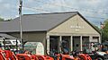
Fire station for Mooers
-
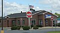
Post office for Mooers


See also
 In Spanish: Mooers (condado de Clinton) para niños
