Morrison, Missouri facts for kids
Quick facts for kids
Morrison, Missouri
|
|
|---|---|

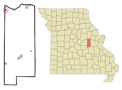
Location of Morrison, Missouri
|
|
| Country | United States |
| State | Missouri |
| County | Gasconade |
| Area | |
| • Total | 0.45 sq mi (1.18 km2) |
| • Land | 0.45 sq mi (1.17 km2) |
| • Water | 0.00 sq mi (0.00 km2) |
| Elevation | 627 ft (191 m) |
| Population
(2020)
|
|
| • Total | 93 |
| • Density | 205.30/sq mi (79.22/km2) |
| Time zone | UTC-6 (Central (CST)) |
| • Summer (DST) | UTC-5 (CDT) |
| ZIP codes |
65036, 65061
|
| Area code(s) | 573 |
| FIPS code | 29-50060 |
| GNIS feature ID | 2395411 |
Morrison is a small city located in Gasconade County, Missouri, in the United States. It is a quiet place with a rich history. The first people to settle here permanently arrived around 1828. According to the 2020 census, 93 people live in Morrison.
Contents
History of Morrison
Morrison has had a post office serving its residents since 1860. The city was named after Alfred William Morrison. He was a legislator, which means he was a person who made laws for the state. It is believed that he once lived in this area.
A special building in Morrison, called the Shobe-Morrison House, is very important. It was added to the National Register of Historic Places in 1983. This list includes buildings and places that are important to the history of the United States.
Geography of Morrison
Morrison is located entirely on land. It covers a total area of about 0.45 square miles (1.17 square kilometers). This is a relatively small area for a city.
Population and People
The number of people living in Morrison has changed over many years. Here is a look at how the population has grown and shrunk:
| Historical population | |||
|---|---|---|---|
| Census | Pop. | %± | |
| 1880 | 118 | — | |
| 1900 | 276 | — | |
| 1910 | 257 | −6.9% | |
| 1920 | 336 | 30.7% | |
| 1930 | 359 | 6.8% | |
| 1940 | 271 | −24.5% | |
| 1950 | 291 | 7.4% | |
| 1960 | 232 | −20.3% | |
| 1970 | 234 | 0.9% | |
| 1980 | 169 | −27.8% | |
| 1990 | 160 | −5.3% | |
| 2000 | 123 | −23.1% | |
| 2010 | 139 | 13.0% | |
| 2020 | 93 | −33.1% | |
| U.S. Decennial Census | |||
What the 2010 Census Showed
In 2010, there were 139 people living in Morrison. These people lived in 52 different homes. Out of these homes, 34 were families.
The population density was about 309 people per square mile (119 people per square kilometer). This means that for every square mile of land, there were about 309 people.
Who Lives in Morrison?
In 2010, all the people living in Morrison were White. About 1.4% of the people were of Hispanic or Latino background.
Many homes had children under 18 years old living there (34.6%). Most homes (59.6%) were married couples living together. Some homes had a single parent, either a mother (3.8%) or a father (1.9%). About 34.6% of homes were not families.
One-quarter of the homes (25.0%) had only one person living in them. About 9.6% of homes had one person who was 65 years old or older. The average number of people in each home was 2.67. For families, the average was 3.29 people.
The average age of people in Morrison was 39.5 years old.
- 29.5% of residents were under 18 years old.
- 4.4% were between 18 and 24 years old.
- 22.3% were between 25 and 44 years old.
- 31% were between 45 and 64 years old.
- 12.9% were 65 years old or older.
The city had slightly more males (51.8%) than females (48.2%).
See also
 In Spanish: Morrison (Misuri) para niños
 | Laphonza Butler |
 | Daisy Bates |
 | Elizabeth Piper Ensley |

