Moruka River facts for kids
Quick facts for kids Moruka River |
|
|---|---|
|
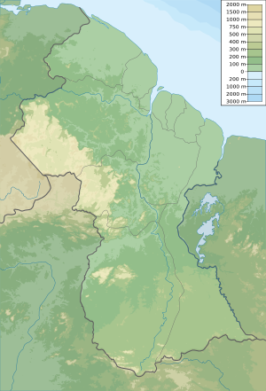
Location of the mouth in Guyana
|
|
| Country | Guyana |
| Physical characteristics | |
| River mouth | Atlantic Ocean 7°40′08″N 58°46′55″W / 7.669°N 58.782°W |
The Moruka River (also spelled Moruca River) is an important river in the Barima-Waini region of northern Guyana. It flows through a beautiful natural area before reaching the Atlantic Ocean.
The river's mouth opens directly into the Atlantic Ocean. Along its shoreline, you'll find thick mangrove forests. As you travel further west, these forests change into swampy savannah wetlands. The amount of water in the Moruka River changes a lot depending on the season. It can be very high during rainy periods and lower during dry times.
Contents
History and Settlements
The Moruka River has been home to people for a very long time.
Ancient Inhabitants and Canoes
About 5,300 years ago, the Warao people lived along the Moruka River. They were very skilled at making dugout canoes. These canoes were boats made from hollowed-out tree trunks. The Warao people's canoes were so good that they helped people travel across the Caribbean Sea. This made it possible for different groups of people to connect and trade.
European Outposts
Later, during the time when the Dutch were exploring and settling in this part of the world, they set up small outposts along the Moruka River. These outposts were like small forts or trading posts. They helped the Dutch control the area and trade with local communities.
Modern Communities
Today, several communities are located along the Moruka River. These include Santa Rosa, which is a large Indigenous village, as well as Kamwatta and Asakata. These villages rely on the river for travel, fishing, and their daily lives.
See also
 In Spanish: Río Moroco para niños
- List of rivers of Guyana
- List of rivers of the Americas by coastline
 | Laphonza Butler |
 | Daisy Bates |
 | Elizabeth Piper Ensley |


