Mount Agassiz (Utah) facts for kids
Quick facts for kids Mount Agassiz |
|
|---|---|

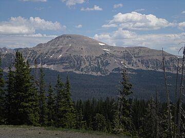
West side of Mt. Agassiz
|
|
| Highest point | |
| Elevation | 12,433 ft (3,790 m) NAVD 88 |
| Prominence | 1,018 ft (310 m) |
| Geography | |
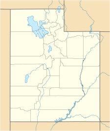
| Location | Duchesne / Summit counties, Utah, U.S. |
| Parent range | Uinta Mountains |
| Topo map | USGS Hayden Peak |
Mount Agassiz is a very tall mountain peak in the Uinta Mountains of northeastern Utah, USA. It stands at an impressive height of 12,433 feet (3,790 m) (about 3,790 meters) above sea level! This makes it one of the higher peaks in the area.
You can find Mount Agassiz inside the High Uintas Wilderness area. It is also part of the Uinta-Wasatch-Cache National Forest. These are protected areas where nature is kept wild and beautiful.
The mountain was named after a famous scientist called Louis Agassiz. He was a very important person who studied many things.
Who Was Louis Agassiz?
Louis Agassiz was a well-known scientist from the 1800s. He studied many different parts of the Earth and its history.
- He was a paleontologist, which means he studied ancient life, like dinosaurs and other fossils.
- He was also a glaciologist, meaning he studied glaciers. Glaciers are huge, slow-moving rivers of ice.
- And he was a geologist, someone who studies the Earth's rocks, soil, and how the planet was formed.
Because of his important work, this amazing mountain was named in his honor.
Weather at Mount Agassiz
The weather on Mount Agassiz can be quite extreme because it's so high up.
Temperatures
In winter, from December to February, it's very cold. The average temperature is usually below freezing, around 13 to 14 degrees Fahrenheit (about -10 to -11 degrees Celsius). Even in summer, from June to August, the weather is cool. The average temperatures are around 42 to 50 degrees Fahrenheit (about 5 to 10 degrees Celsius).
Rain and Snow
Mount Agassiz gets a lot of precipitation, which means rain and snow. The winter months usually bring heavy snowfall. Even in spring, there can be a lot of snow and rain. The summer months are a bit drier, but you can still expect some rain. This helps keep the mountain green and supports its wildlife.
 | William M. Jackson |
 | Juan E. Gilbert |
 | Neil deGrasse Tyson |


