Mount Beevor facts for kids
Quick facts for kids Mount Beevor |
|
|---|---|
| Highest point | |
| Elevation | 503 m (1,650 ft) |
| Geography | |
| Location | South Australia, Australia |
| Parent range | Mount Lofty Ranges |
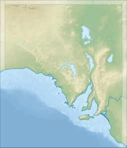
Mount Beevor is a tall peak in South Australia. It stands 503 metres (about 1,650 feet) high. This makes it one of the highest points on the eastern side of the central Mount Lofty Ranges.
Contents
Where is Mount Beevor Located?
Mount Beevor is a rounded hill that is part of a long ridge. This ridge runs from north to south. The mount is about 30 kilometres (18 miles) east of Mount Lofty. It is also about 18 kilometres (11 miles) northeast of Mount Barker. The western slopes of Mount Beevor are the steepest.
Rivers and Geology Near Mount Beevor
The Bremer River starts near the western base of Mount Beevor. From there, it flows south into Lake Alexandrina. Geologically, Mount Beevor is located along the Bremer Fault Scarp. This is a natural break in the Earth's crust.
Localities Around the Summit
The top of Mount Beevor is a special meeting point. It is where the borders of three different areas meet. These areas are Harrogate, Rockleigh, and Tungkillo. All these places are part of the Rural City of Murray Bridge. The summit also marks the edge of two old land divisions. These are the County of Sturt and the Hundred of Monarto.
What is the Climate Like at Mount Beevor?
Mount Beevor does not get much rain. Early settlers found it hard to find water in this area. The peak can be very windy. In winter, it can be cold, foggy, and bleak. There is little shelter from the weather.
Extreme Weather Events
In July 1901, heavy snowstorms covered Mount Beevor. In contrast, summer thunderstorms can cause floods. They turn small streams into fast-flowing rivers. This can wash out nearby roads. In its natural state, the land did not capture much water. This led to severe flooding downstream, especially along the Bremer River.
Enjoying the Views
Between these extreme weather times, there are often clear days. On these days, you can see amazing views. You can look out over the ridges and hills. These areas are often covered with beautiful wildflowers.
Who Discovered Mount Beevor?
The first people to live in this area were the Peramangk people. They were Indigenous Australians. We do not know what they called the mount. They did not stay long because the mount was quite barren.
First European Visitors
The first Europeans to see Mount Beevor were Dr George Imlay and John Hill. They visited on January 25, 1838. They were riding back to Adelaide from Mannum. They had been the first Europeans to reach the Murray River overland in South Australia. At first, they thought Mount Beevor was Mount Barker. Even after they realized their mistake, they did not name the peak.
How Mount Beevor Got Its Name
The name Mount Beevor comes from Captain Beevor. He was a former British Army soldier. In late 1839, he became the first European settler in this area. He started a sheep farm there. His main farm building was near the southern base of the mount. His shepherds' huts were spread all around. In 1844, Beevor moved to start another sheep farm on Eyre Peninsula. Sadly, he was killed there in 1849.
Later Owners and Their Legacy
Later, the Murray family owned the land. Their Mount Beevor Estate became famous. It was known for producing some of the best wool in South Australia. It was also a top place for breeding merino sheep. Thomas Hope Murray (1854-1905) and his family lived there. Their home had fifteen large rooms. From 1906, Norman Edward Brice (1864-1927) and his family continued the estate's good reputation.
What is the Economy Like Around Mount Beevor?
Mount Beevor is in an area known for farming. The slopes of the mount are mostly grassy. They have some rocky spots and groups of eucalyptus trees. These areas are used for grazing livestock like sheep.
Modern Communications Hub
In recent years, the summit has become important for communications. Tall towers are located there. These towers help send and receive signals across the area. They are used by Telstra (a phone company), mobile phone providers, and Emergency Services. They are also used for C.B. Radio. A special track allows people to service these towers. However, it is closed to the public.
Tourism and Recreation
Hiking has become popular more recently. On clear days, you can see amazing views from the top of Mount Beevor. Because of these views, it is now an important stop on the Lavender Federation Trail. This is a walking trail that goes between Murray Bridge and Truro.
 | Stephanie Wilson |
 | Charles Bolden |
 | Ronald McNair |
 | Frederick D. Gregory |


