
Mount Lofty Ranges facts for kids
Quick facts for kids Mount Lofty Ranges |
|
|---|---|

The summit of Mount Lofty
|
|
| Highest point | |
| Peak | Mount Bryan |
| Elevation | 936 m (3,071 ft) AHD |
| Isolation | 102.07 km (63.42 mi) |
| Dimensions | |
| Length | 300 km (190 mi) N-S |
| Area | 1,640 km2 (630 sq mi) |
| Naming | |
| Etymology | Mount Lofty |
| Geography | |
| Country | Australia |
| State | South Australia |
| Parent range | Adelaide Rift Complex |
| Geology | |
| Orogeny | Palaeozoic |
| Age of rock | Cambrian |
| Type of rock | Sedimentary |
| Volcanic arc/belt | Adelaide Rift Complex |
| Last eruption | March 1954 |
| Climbing | |
| Normal route | Heysen Trail |
| Access | South Eastern Freeway |
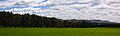
The Mount Lofty Ranges are a chain of mountains located just east of Adelaide in the Australian state of South Australia. These ranges are a key part of the landscape, offering beautiful views and important natural areas close to the city.
Contents
Where are the Mount Lofty Ranges?
The Mount Lofty Ranges stretch for over 300 kilometers (about 186 miles). They begin at the very southern tip of the Fleurieu Peninsula at Cape Jervis. From there, they extend northwards, eventually fading out north of Peterborough.
Near Adelaide, these mountains act like a natural barrier. They separate the flat Adelaide Plains from the wide plains that surround the Murray River. These eastern plains reach all the way to the state of Victoria.
Exploring the Ranges: The Heysen Trail
A famous walking path called the Heysen Trail runs almost the entire length of the Mount Lofty Ranges. This trail is perfect for adventurers! It even crosses westwards towards the Flinders Ranges near Hallett.
What is the climate like?
The Mount Lofty Ranges have a Mediterranean climate. This means they get moderate rainfall, mostly brought by winds from the southwest. Summers are hot, and winters are cool. The southern parts of the ranges are wetter, receiving about 900 millimeters (35 inches) of rain each year. The northern parts are drier, with about 400 millimeters (16 inches) of rain annually.
Southern Mount Lofty Ranges
The southern part of the ranges includes areas like the Barossa Valley. This section is often called the South Mount Lofty Ranges. The highest point here is the summit of Mount Lofty, which stands at 727 meters (2,385 feet) tall. The area closest to Adelaide is known as the Adelaide Hills, and further north, you'll find the Barossa Range.
How do people use the land?
The land in the southern ranges is used for many different things.
- Homes: Many people live here, especially in the foothills and towns like Stirling, Bridgewater, Mount Barker, and Victor Harbor.
- Forests: There are several pine tree plantations, particularly around Mount Crawford, Cudlee Creek, Kuitpo Forest, and Second Valley.
- Protected Areas: To protect nature, several parks exist near Adelaide. These include Black Hill Conservation Park, Cleland Conservation Park, and Belair National Park. Other important parks are Deep Creek Conservation Park and Para Wirra Conservation Park.

Wineries and Mining History
The ranges are home to many wineries. Two wine regions are famous worldwide: the Barossa Valley and McLaren Vale. Grapes are also grown in the Adelaide Hills and the Onkaparinga Valley.
While no big mines operate today, there were many in the past. South Australia didn't have a huge gold rush like other states, but gold was mined near Echunga and Williamstown.
Water Supply for Adelaide
The Mount Lofty Ranges are a vital source of water for Adelaide. There's a large system of reservoirs, weirs, and pipelines. These collect water from rivers like the Torrens, Onkaparinga, Little Para, and Gawler River. Some of the largest reservoirs include Mount Bold, South Para, Kangaroo Creek, and Millbrook.
Northern Mount Lofty Ranges
The northern part of the ranges is sometimes called the "Mid-North ranges." They stretch from hills near Kapunda in the south to drier ranges beyond Peterborough in the northeast. The highest peak in all the Mount Lofty Ranges is actually here: Mount Bryan, standing at 936 meters (3,071 feet). Other notable peaks include New Campbell Hill (714 meters or 2,343 feet) and Stein Hill (605 meters or 1,985 feet), which overlooks Burra.
Mining in the North
Mining was once a very important industry in the northern ranges, though it's not active today.
- The copper mine at Kapunda operated from 1842 to 1877. It greatly helped the new state's economy.
- Even bigger copper workings were found at Burra. This mine operated from 1845 to 1877. It even reopened briefly in 1971 before closing again.
The Clare Valley and Unique Spots
The Clare Valley is a beautiful wine-producing area located in a shallow fold of the northern ranges, southwest of Burra. It's a popular place for tourists from Adelaide to visit on weekends. It also has the only conservation park in the northern ranges, Spring Gully.
The northern end of the ranges has a couple of interesting places:
- Yongala: A tiny town known for often being the coldest place in South Australia.
- Magnetic Hill: Near Orroroo, this spot has a strange reputation. People say if you park your car there, it will roll uphill!

How the Mountains Were Formed: Geomorphology
The Mount Lofty Ranges are part of something called the Adelaide Rift Complex. If you look at the ranges from the beach or city, they seem to have a "stepped" look, which is why they were once called "The Tiers."
Earthquakes and Fault Lines
There are several major normal faults (cracks in the Earth's crust) in the Adelaide region. These faults run from northeast to southwest and help shape the different blocks of land.
All these fault zones are still active today, meaning the ranges are slowly moving. Small earthquakes happen quite often. Larger earthquakes are rare, but they do occur. The last significant one to hit a major center was the 1954 Adelaide earthquake on March 1, which measured 5.5 on the Richter scale.
Wildlife and Plants: Ecology
The Mount Lofty Ranges are home to a variety of plants and animals.


Plants of the Ranges
The natural environment on the mountainsides is mostly eucalyptus woodland. On the lower slopes, you'll also find golden wattle acacia trees. Underneath these trees, there are shrubs and herbs. Many unique orchids grow here. Similar plant life can be found on Kangaroo Island, which is part of the Mount Lofty woodlands ecoregion as identified by the World Wildlife Fund. Kangaroo Island has even more unique plant species than the mainland.
Animals of the Ranges
The mountains are home to several marsupials (mammals with pouches), such as the koala, western gray kangaroo, southern brown bandicoot, and the tammar wallaby (on Kangaroo Island). You can also find the monotreme (egg-laying mammal) called the echidna. The platypus lives only on Kangaroo Island.
Birds include the southern emu-wren, which is found only on the Fleurieu Peninsula. There are also several reptiles, including the endangered Adelaide pygmy blue-tongue skink.
Challenges for Wildlife and Nature Preservation
Sadly, much of the woodland on the hillsides has been cleared. This happened to make way for fruit farms, other agriculture, and the growing city of Adelaide. This loss of habitat has caused some wildlife species to disappear from the area. For example, all types of bettong and quoll marsupials are gone, as are birds like the regent honeyeater and swift parrot.
Clearing land and farming continue to affect habitats. Livestock grazing also causes damage. Animals like introduced cats, foxes, and rabbits are a threat to the native wildlife. The protected areas that exist tend to be small and spread out. Kangaroo Island has been less affected and doesn't have rabbits or foxes. However, koalas were introduced there from the mainland and are now causing some damage to the island's habitats.
Images for kids
-
Wind turbines northwest of Burra.
See also
 In Spanish: Montes Lofty para niños
