Cape Jervis (headland) facts for kids
Quick facts for kids Cape JervisCape Jervis, South Australia |
|
|---|---|

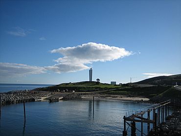
Sealink Terminal, Cape Jervis
|
|
| Location | 0.7 km (0 mi) west of Cape Jervis |
Cape Jervis is a special piece of land that sticks out into the sea. It's located at the very western tip of the Fleurieu Peninsula in South Australia. This area is on the eastern side of Gulf St Vincent. It's also very close to the town of Cape Jervis, about 0.7 kilometers west. Think of it as the eastern "doorway" to Gulf St Vincent!
Contents
What is Cape Jervis?
Cape Jervis is a high, strong headland. It doesn't have much plant life. The land is cut by small valleys called gullies. It also has several parts that stick out like cliffs. The most noticeable part, called "The Cape," doesn't drop steeply into the sea. Instead, it slopes down slowly from the higher land inland. A hill called Tree Hill, which is 345 meters high, is a key landmark nearby.
How Cape Jervis Got Its Name
Local Aboriginal people knew this place by different names. The Ngarrindjeri people called it "Parewarangk." This name came from the Kaurna name Pariwarangga.
Later, explorers from Europe visited the cape. The Baudin expedition from France came after the British explorer Matthew Flinders. The French gave it two names: "Cap D'Alembert" and "Cap De La Secheresse." "Cap D'Alembert" was the one written in their official records.
However, the name that stuck was given by the British explorer, Matthew Flinders. He named it Cape Jervis on March 23, 1802. He named it after John Jervis, 1st Earl of St Vincent, a famous British admiral.
Early Activities at the Cape
In the past, Cape Jervis was a busy place for whaling. A shore-based bay whaling station operated here by 1842. It was run by a person named John Haynes. Whaling stations were places where whales were caught and processed for their oil and other products.
Over the years, the ownership of this whaling station changed hands several times. It was bought by Mr. Baker in 1845. By 1850, Mr. Barnett owned it, and Mr. Clark managed it for him. In 1851, Messrs Boord, Bennett, and Johnson owned the fishery. It seems that 1851 was the last year the whaling station was in operation.
Modern Day Cape Jervis
Cape Jervis is still an important location today.
- Since 1871, it has had a lighthouse. Lighthouses are tall towers with bright lights that help ships find their way and avoid danger, especially at night.
- Right next to the lighthouse, there is a boat harbor. This harbor has a long jetty, which is like a pier, stretching 120 meters into the water.
- This jetty is used by Kangaroo Island SeaLink. This company runs a ferry service from Cape Jervis to Penneshaw on Kangaroo Island. Many people use this ferry to visit the island.
- Since 2012, the waters around Cape Jervis are part of the Encounter Marine Park. This park helps protect the ocean and its amazing sea creatures.
 | William M. Jackson |
 | Juan E. Gilbert |
 | Neil deGrasse Tyson |


