Cape Jervis facts for kids
Quick facts for kids Cape JervisSouth Australia |
|||||||||||||||
|---|---|---|---|---|---|---|---|---|---|---|---|---|---|---|---|

Sealink Terminal, Cape Jervis
|
|||||||||||||||
| Population | 264 (2016 census) | ||||||||||||||
| Established | 1954 (sub-division) 5 August 1999 (locality) |
||||||||||||||
| Postcode(s) | 5204 | ||||||||||||||
| Time zone | ACST (UTC+9:30) | ||||||||||||||
| • Summer (DST) | ACST (UTC+10:30) | ||||||||||||||
| Location | 88 km (55 mi) from Adelaide | ||||||||||||||
| LGA(s) | District Council of Yankalilla | ||||||||||||||
| Region | Fleurieu and Kangaroo Island | ||||||||||||||
| County | Hindmarsh | ||||||||||||||
| State electorate(s) | Mawson | ||||||||||||||
| Federal Division(s) | Mayo | ||||||||||||||
|
|||||||||||||||
|
|||||||||||||||
| Footnotes | Adjoining localities | ||||||||||||||
Cape Jervis is a small town in the Australian state of South Australia. It is located at the western tip of the Fleurieu Peninsula. This town is about 88 kilometers (55 miles) south of Adelaide, the state capital.
The town is named after the nearby headland. This headland is also known by its Aboriginal name, Parewarangk. Matthew Flinders named it on March 23, 1802. He named it after John Jervis, 1st Earl of St Vincent.
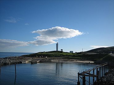
Cape Jervis overlooks three important bodies of water. These are the Gulf St Vincent, Investigator Strait, and Backstairs Passage. It also has the Cape Jervis Lighthouse and a port. This port is used by Kangaroo Island SeaLink for ferries to Penneshaw on Kangaroo Island.
In August 2016, a census showed that 264 people lived in Cape Jervis.
Contents
Discover Cape Jervis
Cape Jervis is a great place to visit. It offers many activities for people who love nature and the outdoors.
Where is Cape Jervis Located?
Cape Jervis is found at the very end of the Fleurieu Peninsula. It sits where the Main South Road finishes. This road connects it to Adelaide. The town is important because it's the main ferry point for Kangaroo Island.
Fun Things to Do in Cape Jervis
Cape Jervis is the starting point for the Heysen Trail. This is a very long walking track, about 1200 kilometers (746 miles) long. It goes all the way to Parachilna Gorge in the Flinders Ranges.
Visitors can also explore nearby nature spots.
- The Deep Creek Conservation Park is a beautiful area for hiking and seeing wildlife.
- The Talisker Conservation Park is another great place for nature walks.
There are two interesting beaches close by:
- Morgan's Beach, where you can see the remains of an old fishing boat called the Ellen.
- Fisheries Beach, which has parts of an old whaling station.
Cape Jervis is also a popular spot for fishing. Many people go there to start fishing trips on boats.
Local Government and Representation
Cape Jervis is part of several government areas.
- It is in the federal division of Mayo.
- For state elections, it is in the Mawson district.
- Locally, it is managed by the District Council of Yankalilla.
 | Precious Adams |
 | Lauren Anderson |
 | Janet Collins |


