Mount Chirripó facts for kids
Quick facts for kids Mount Chirripó |
|
|---|---|
 |
|
| Highest point | |
| Elevation | 3,821 m (12,536 ft) |
| Prominence | 3,727 m (12,228 ft) |
| Listing |
|
| Geography | |
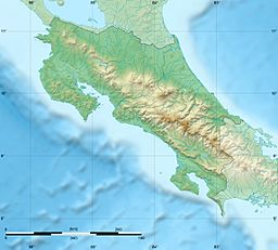
| Location | Chirripó National Park, Costa Rica |
| Parent range | Talamanca Range |
| Climbing | |
| First ascent | 1904 Agustín Blessing Presinger |
| Easiest route | Hiking |
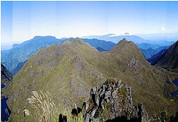
Mount Chirripó is the tallest mountain in Costa Rica. It stands at 3,821 meters (12,536 feet) high. This amazing peak is part of the Talamanca Range, which is a long chain of mountains.
The mountain is inside Chirripó National Park. It is famous for its rich plant and animal life. Local indigenous people named it "Chirripó," which means "land of eternal waters." This is because many lakes and streams are found around the mountain.
The high peaks in Chirripó National Park and La Amistad International Park are home to special forests. These include the Talamancan montane forest and Costa Rican Páramo. Many unique plants and animals live here that are found nowhere else. These mountain peaks are like "sky islands" for many species.
It has not snowed on Mount Chirripó in about 100 years. However, people sometimes report seeing hail fall. The mountain is so tall that on clear days, you can see both the Pacific Ocean and the Caribbean Sea from its top!
You can hike Mount Chirripó if you get a permit. You can get this permit from the National Park office in San Gerardo de Rivas. The hike to the top is about 19.5 kilometers (12.1 miles) long. Temperatures on the peak can range from 4˚C to 18˚C during the day. At night, they can drop below freezing.
Contents
History of Mount Chirripó
The first people known to live near Chirripó were the Cabécar, an indigenous group. In 1904, a person named Agustín Blessing Presinger was the first known European to climb the mountain.
Developing the Hiking Trail
The first official hiking trail was built in 1965. It led to a small metal hut about five kilometers from the peak. Today, that hut has been replaced by a strong concrete building. About 7,000 people visit this building every year.
Protecting the Area
In 1975, Chirripó National Park was created. This park protects about 500 square kilometers of rainforest and mountains around the peak. This helps keep the unique plants and animals safe.
Hiking to the Summit
The hike to Mount Chirripó starts in the village of San Gerardo de Rivas. This village is about 1,500 meters above sea level.
The Journey Up the Mountain
From the valley, the path goes through fields and woodlands. Then, it climbs through a lush rainforest. As you go higher, the forest slowly changes into scrubland. The trail goes up and down over ridges and valleys.
Reaching the Refuge and Peak
Eventually, you will reach the main visitors' refuge. This refuge is at 3,392 meters high. From the refuge, it takes about two more hours to hike to the very top. After crossing the last ridge, there is a steep path for about 200 meters. The summit itself is a wide, flat area of rocks, about 6 meters across.
See also
 In Spanish: Cerro Chirripó para niños
- Mountain peaks of North America
- List of Ultras of Central America
 | Stephanie Wilson |
 | Charles Bolden |
 | Ronald McNair |
 | Frederick D. Gregory |


