Mount McKay facts for kids
Quick facts for kids Mount McKay |
|
|---|---|

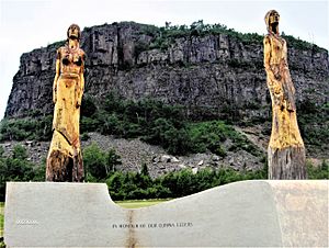
Mount McKay as seen from the Neste Boat Launch
|
|
| Highest point | |
| Elevation | 483 m (1,585 ft) |
| Geography | |
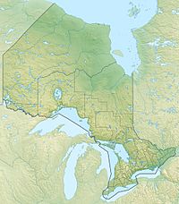
| Location | Fort William First Nation, Ontario, Canada |
| Parent range | Nor'Wester Mountains |
| Geology | |
| Age of rock | Precambrian |
| Mountain type | Sill |
Mount McKay is a cool mountain located near Thunder Bay, Ontario, Canada. It sits on the land of the Fort William First Nation. This mountain is the tallest and most northern peak in the Nor'Wester Mountains. It formed about 1.1 billion years ago from melted rock that pushed its way up.
History of Mount McKay
The Ojibwe people have a special name for Mount McKay. They call it "Thunder Mountain" (Animikii-wajiw). This mountain is a very important and sacred place for them. They use it for traditional ceremonies. For a long time, only First Nations people could easily reach the mountain.
The name "Mount McKay" comes from "Mackay's Mountain." This name was given after William Mackay. He was a Scottish trader who lived in the Fort William area many years ago.
Geology and Formation
Mount McKay stands about 299 meters (981 feet) above Lake Superior. It reaches 483 meters (1,585 feet) above sea level. It has a flat top with steep cliffs on three sides.
The mountain is made of layers of rock. The bottom layers are shale and greywacke. These are covered by a very hard layer of rock called diabase. This diabase cap is about 60 meters (197 feet) thick. It protects the softer rocks underneath from wearing away. This hard cap is what makes Mount McKay flat-topped.
Geologists believe this diabase cap is what's left of a huge sheet of rock. This sheet once covered the whole area. It formed about 1.1 billion years ago.
Features and Views
Mount McKay offers amazing views from its lower eastern side. There is a lookout point about 300 meters (984 feet) up. From here, you can see all of Thunder Bay and its busy harbor. There is also a small memorial at the lookout. It honors Aboriginal people who fought in wars.
You can find different plants on the mountain. These include red and sugar maple trees. You might also see poison ivy, which the Ojibwe call "thunder-leaf." The very top of the mountain has large rocks left behind by glaciers. There are also jack pine trees growing there.
There are some trails on Mount McKay. However, the Fort William First Nation asks visitors not to climb the mountain. They consider Animikii-wajiw to be sacred ground. It is important to respect their wishes and the cultural importance of this special place.
 | Janet Taylor Pickett |
 | Synthia Saint James |
 | Howardena Pindell |
 | Faith Ringgold |


