Mount Pinchot (Montana) facts for kids
Quick facts for kids Mount Pinchot |
|
|---|---|

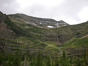
Stream cascades down the face of Mount Pinchot
|
|
| Highest point | |
| Elevation | 9,315 ft (2,839 m) |
| Prominence | 1,879 ft (573 m) |
| Geography | |
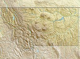
| Location | Flathead County, Montana, U.S. |
| Parent range | Lewis Range |
| Topo map | USGS Mount Saint Nicholas, MT |
Mount Pinchot is a tall mountain found in the beautiful Glacier National Park in Montana, U.S.A. It stands at an impressive height of about 9,315 feet (2,839 meters) above sea level. This mountain is part of the Lewis Range, a group of mountains known for their rugged beauty.
Mount Pinchot is located less than 1.5 miles (2.4 km) southeast of another mountain called Mount Stimson. If you look southeast from Mount Pinchot, you'll find a lovely body of water known as Beaver Woman Lake.
About Mount Pinchot
Mount Pinchot is a significant landmark within Glacier National Park. It's a popular spot for hikers and nature lovers who want to explore the park's amazing scenery. The mountain's slopes are often covered in forests and rocky areas, with streams flowing down its sides.
How it Got its Name
Mount Pinchot was named after a very important person named Gifford Pinchot. He was a pioneer in forestry, which means he was one of the first people to study and manage forests in a smart way. Gifford Pinchot also helped create and lead the United States Forest Service. This is a government agency that protects and manages national forests and grasslands.
The name "Mount Pinchot" was officially approved on March 6, 1929, by the United States Board on Geographic Names. This board is responsible for making sure that places in the U.S. have official and consistent names.
 | May Edward Chinn |
 | Rebecca Cole |
 | Alexa Canady |
 | Dorothy Lavinia Brown |


