Mount Sizer facts for kids
Quick facts for kids Mount Sizer |
|
|---|---|

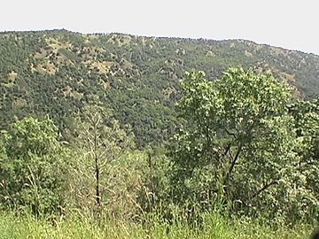
Mount Sizer, highest point in photo as seen from Hobbs Road just above Deer Horn Spring.
|
|
| Highest point | |
| Elevation | 3,219 ft (981 m) NAVD 88 |
| Geography | |
| Location | Santa Clara County, California, U.S. |
| Parent range | Diablo Range |
| Topo map | USGS Mount Sizer |
| Climbing | |
| Easiest route | Hike |
Mount Sizer is a tall mountain peak found in Henry W. Coe State Park in California. It is located on a ridge called Blue Ridge, just east of Morgan Hill, California. Mount Sizer is the highest point on Blue Ridge. It is also less than 10 miles (about 16 kilometers) from the park's main office. This makes it a great spot for people who like to hike for a day.
Contents
How Tall is Mount Sizer?
Mount Sizer stands at an elevation of about 3,219 feet (981 meters) above sea level. Some park maps show its height as 3,216 feet. This difference is very small. It is still a significant peak in the area.
Exploring Mount Sizer: Hiking Trails
There are two main ways to reach the top of Mount Sizer. Both ways offer a fun challenge for hikers.
The Trail Route
One way to get to the summit is by following marked hiking trails. These trails wind through the park's beautiful natural areas. They offer a more gradual climb to the top.
The Shortcut: A Fire Road
The second way to reach Mount Sizer is by using a combination of trails and a special road. This road is called a "fire road." Fire roads are used by park rangers to access remote areas, especially for fighting wildfires. This particular fire road goes almost straight up Blue Ridge to Mount Sizer. Hikers sometimes call it "The Shortcut."
The Shortcut is very steep. It climbs about 1,500 feet (457 meters) in just 1.3 miles (2.1 kilometers). This means it has an average slope, or "grade," of 22%. A 22% grade is quite challenging for hikers. It is a good workout for anyone who tries it!
 | Stephanie Wilson |
 | Charles Bolden |
 | Ronald McNair |
 | Frederick D. Gregory |

