Mountain Fire (2024) facts for kids
Quick facts for kids Mountain Fire |
|
|---|---|

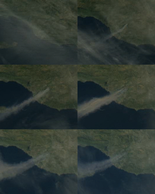
GOES-18 loop of the fire on 6 November
|
|
| Location |
|
| Coordinates | 34°19′05″N 118°58′05″W / 34.318°N 118.968°W |
| Statistics | |
| Date(s) |
|
| Burned area | 14,148 acres (5,725 ha; 22 sq mi; 57 km2) |
| Cause | Under investigation |
| Buildings destroyed | Multiple |
| Non-fatal injuries | Multiple |
The Mountain Fire is an active wildfire burning in Ventura County, Southern California. As of November 6th, 2024, the fire has burned 14,148 acres (5,725 hectares) and caused multiple injuries.
Contents
Background
The Mountain Fire began amid an episode of strong Santa Ana winds in Southern California. The SPC outlined an "extremely critical" area on the Day 1 fire weather outlook, warning of very low relative humidity values below 20%, combined with strong offshore winds with gusts over 60 mph. A particularly dangerous situation red flag warning was issued for November 6-7 in the area.
Progression
The fire was first reported at 8:50 a.m. PST "near the 7900 block of Balcom Canyon Road and Bradley Road", according to CBS News and the Ventura County Fire Department. The fire grew to approximately 1,000 acres (400 ha) in the hour after its ignition. At approximately 11:00 a.m., the fire crossed State Route 118 and began to impinge on the Camarillo Heights neighborhood. As of November 6, 2024[update], the fire has burned 10,400 acres (4,200 ha) and is zero percent contained.
On November 6, KTLA reporter Sara Welch reported that "winds are so fierce that they can’t get any fixed-wing aircraft up there to drop any water".
Effects
Multiple people have been injured in the fire and multiple structures have been destroyed. Evacuation orders were issued for parts of Ventura County.
See also
- Glossary of wildfire terms
- List of California wildfires
- Maria Fire

