Mud Run (Green Creek tributary) facts for kids
Quick facts for kids Mud Run |
|
|---|---|

Mud Run from Utt Road
|
|
| Physical characteristics | |
| Main source | Greenwood Township, Columbia County, Pennsylvania |
| River mouth | Green Creek in Greenwood Township, Columbia County, Pennsylvania 600 ft (180 m) 41°07′05″N 76°25′33″W / 41.1180°N 76.4257°W |
| Length | 5.7 mi (9.2 km) |
| Basin features | |
| Progression | Green Creek → Fishing Creek → Susquehanna River → Chesapeake Bay |
| Basin size | 13.3 sq mi (34 km2) |
| Tributaries |
|
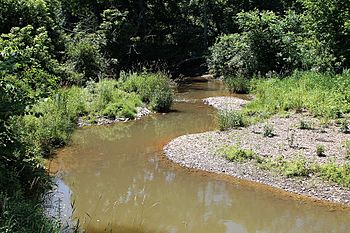
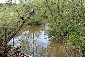
Mud Run is a small stream in Columbia County, Pennsylvania, USA. It flows into Green Creek. Mud Run is about 5.7 miles (9.2 km) long. It mostly flows through Greenwood Township. The area of land that drains into Mud Run is called its watershed. This watershed covers 13.3 square miles (34.4 square km). It includes parts of Greenwood, Orange, and Mount Pleasant Townships. Mud Run is located in a hilly area known as the Ridge-and-Valley Appalachians. A famous old bridge, the Kramer Covered Bridge, crosses this stream.
Contents
Where Does Mud Run Flow?
Mud Run starts in Greenwood Township. It begins on the west side of a place called Bunker Hill. At first, the stream flows south. Soon after, it goes under Pennsylvania Route 254.
Then, Mud Run turns to the southeast. It flows into an area known as the Greenwood Valley. The stream then turns east. It runs along the southern edge of the valley for several miles. Along the way, it picks up water from smaller streams. These smaller streams don't have names. Near its end, Mud Run bends southeast. It then flows into Green Creek. This happens right where Greenwood Township meets Orange Township.
Why Is Mud Run Sometimes Muddy?
Mud Run gets its name because it can be quite muddy. This happens especially after a lot of rain. The stream carries a lot of tiny bits of dirt, called sediment.
The amount of sediment in Mud Run is quite high. Most of this sediment comes from farmlands. About 3.3 million pounds (1.5 million kg) of sediment come from croplands each year. Stream banks also add a lot of sediment. Hay fields and pastures contribute too. Even forests add some sediment, but much less.
The Pennsylvania Department of Environmental Protection checks the health of streams. They consider all of Mud Run and its smaller streams to be "impaired." This means the water quality is not as good as it should be.
Mud Run's Surroundings and Land
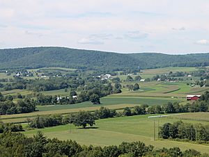
Mud Run is in a region called the Ridge-and-Valley Appalachians. This area has many long, parallel ridges and valleys.
The land around Mud Run changes a lot in height. Some areas are below 600 feet (180 m) above sea level. Others are more than 1,340 feet (410 m) high. Near where Mud Run joins Green Creek, the elevation is exactly 600 feet (180 m). There are many steep hillsides in this area.
The Mud Run Watershed
The watershed of Mud Run covers 13.3 square miles (34.4 square km). A watershed is all the land where water drains into a particular stream or river. Most of this watershed is in Greenwood Township. But parts of it are also in Orange Township and Mount Pleasant Township.
The biggest use of land in the watershed is farming. About 49.3% of the land is used for agriculture. This includes fields for crops and pastures for animals. Forests cover almost as much land, about 45.4%. A small part of the land is developed, like for homes. A tiny bit is made up of wetlands.
There are about 19.9 miles (32.0 km) of streams in the Mud Run watershed. The Pennsylvania Department of Environmental Protection says that 14.2 miles (22.9 km) of these streams are "impaired." This means they are not as healthy as they should be.
Animals and Nature Around Mud Run
Mud Run is a special place for fish. It is known as a trout-stocked fishery. This means that trout are put into the stream for people to catch. It's also a migratory fishery, meaning fish travel through it.
Farmers in the area don't widely use special conservation methods. These methods help protect the soil and water. Also, there are not many riparian buffers along the stream. Riparian buffers are strips of plants and trees along a stream. They help filter pollution and keep the stream banks strong.
The Kramer Covered Bridge
The Kramer Covered Bridge No. 113 is a historic bridge that crosses Mud Run. It was built a long time ago, in 1881. The bridge was named after Alexander Kramer, who was a farmer in the area. This covered bridge is 50 feet (15 m) long. It was fixed up in 2008 to keep it safe and strong.
 | Janet Taylor Pickett |
 | Synthia Saint James |
 | Howardena Pindell |
 | Faith Ringgold |


