Mulambin, Queensland facts for kids
Quick facts for kids MulambinQueensland |
|||||||||||||||
|---|---|---|---|---|---|---|---|---|---|---|---|---|---|---|---|

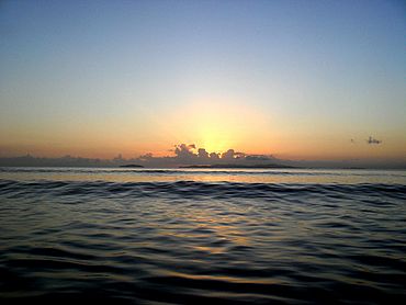
Sunrise from Mulambin Beach looking out towards Great Keppel Island, 2012
|
|||||||||||||||
| Population | 921 (2016 census locality) | ||||||||||||||
| • Density | 161.6/km2 (419/sq mi) | ||||||||||||||
| Postcode(s) | 4703 | ||||||||||||||
| Area | 5.7 km2 (2.2 sq mi) | ||||||||||||||
| Time zone | AEST (UTC+10:00) | ||||||||||||||
| LGA(s) | Shire of Livingstone | ||||||||||||||
| State electorate(s) | Keppel | ||||||||||||||
| Federal Division(s) | Capricornia | ||||||||||||||
|
|||||||||||||||
Mulambin is a coastal town and locality in the Livingstone Shire, Queensland, Australia. It is a lovely spot right by the sea. In 2016, about 921 people lived in Mulambin.
Exploring Mulambin's Location
Mulambin is located right on the coast. Its eastern side is a beautiful beach that faces the Coral Sea. This means you can enjoy amazing ocean views and beach activities.
Along the beach, there's a road called the Scenic Highway. It runs from north to south, acting like a boardwalk between the beach and the houses.
On the western side of Mulambin, you'll find Mulambin Creek. This creek flows from the north down to Causeway Lake. A big part of the western area is undeveloped land, which means it's mostly natural bushland.

All content from Kiddle encyclopedia articles (including the article images and facts) can be freely used under Attribution-ShareAlike license, unless stated otherwise. Cite this article:
Mulambin, Queensland Facts for Kids. Kiddle Encyclopedia.

