Munson, Alberta facts for kids
Quick facts for kids
Munson
|
|
|---|---|
|
Village
|
|
| Village of Munson | |
 |
|
| Country | Canada |
| Province | Alberta |
| Region | Central Alberta |
| Census Division | No. 5 |
| Municipal district | Starland County |
| Incorporated | |
| • Village | May 5, 1911 |
| Area
(2021)
|
|
| • Land | 2.56 km2 (0.99 sq mi) |
| Elevation | 825 m (2,707 ft) |
| Population
(2021)
|
|
| • Total | 170 |
| • Density | 66.3/km2 (172/sq mi) |
| Time zone | UTC−7 (MST) |
| • Summer (DST) | UTC−6 (MDT) |
| Highways | 9 |
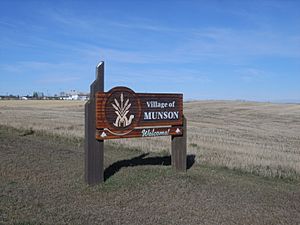
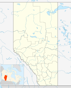
Munson is a small village in central Alberta, Canada. You can find it about 13 kilometers north of the town of Drumheller. It's right along Highway 9 and the Canadian National Railway tracks.
Munson's Past: A Railway Camp
Munson has an interesting past. Before World War I ended, it was home to a special camp. This camp was for immigrants from Ukraine who were not yet Canadian citizens. They worked on the railway tracks there.
The camp stayed open until March 21, 1919. People lived in shelters made from old railway cars.
How Many People Live in Munson?
Every few years, Statistics Canada counts how many people live in different places. This is called a census.
In the 2021 census, 170 people lived in Munson. They lived in 74 homes. This number was a bit lower than in 2016.
In the 2016 census, Munson had 192 people. They lived in 82 homes. The village covers an area of about 2.56 square kilometers.
 | Valerie Thomas |
 | Frederick McKinley Jones |
 | George Edward Alcorn Jr. |
 | Thomas Mensah |


