Mylor Creek facts for kids
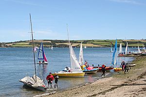
Mylor Creek is a beautiful tidal creek in south Cornwall, United Kingdom. A creek is like a small arm of the sea that reaches inland. In the local Cornish language, it's called Pol Scathow, which means 'creek of boats'.
This creek is part of a larger water system called Carrick Roads. Carrick Roads is the wide mouth of the River Fal. Mylor Creek is about 10 kilometers (6 miles) south of Truro and 3 kilometers (2 miles) north of Falmouth.
Contents
Exploring Mylor Creek's Location
Mylor Creek is located within the Mylor civil parish. It forms a peaceful inland lake that changes with the tides.
How Big is Mylor Creek?
At its widest point, the creek is about 240 meters (800 feet) across. It stretches for just over 1.8 kilometers (1 mile) from its start at Mylor Bridge to where it meets Carrick Roads.
Key Spots Along the Creek
- The creek begins at Mylor Bridge, which is its normal tidal limit. 50°11′02″N 5°04′38″W / 50.18396°N 5.07727°W
- Its mouth, where it flows into Carrick Roads, is near Mylor Harbour. 50°10′44″N 5°03′13″W / 50.17882°N 5.05369°W
Mylor Creek Through Time
Mylor Creek has a rich history, especially because of its location near the sea.
Long ago, the entrance to Mylor Creek was home to an important naval dockyard. This was the most westerly naval base in Britain. It was a place where navy ships could be repaired and supplied.
In the late 1800s, a famous training ship called HMS Ganges was based here. It helped train young boys to become sailors. The Falmouth Packets, which were ships that carried mail and passengers, also used this harbor.
World War II and Oyster Fishing
During World War II, Mylor Harbour was a secret base. It was used for special operations by the French Resistance, who were fighting against the occupation of France.
Today, Mylor Creek is still important for fishing. It is home to the last group of traditional oyster fishermen in the area. They continue to catch oysters using old methods.
Fun Activities at Mylor Creek
The waters around Mylor Creek and Carrick Roads are very popular for water sports.
Sailing and Racing
Many people enjoy yachting and dinghy racing here. The calm waters are perfect for learning to sail or for competitive races.
Restronguet Sailing Club is a well-known club located at Mylor Harbour. This large marina is just north of Mylor Churchtown. Even though the club is named after Restronguet Creek, which is a bit further north, its main base is right here at Mylor.


