Restronguet Creek facts for kids
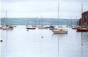
Restronguet Creek is a special type of tidal river valley in south Cornwall, United Kingdom. It's like a smaller arm of the River Fal's wide mouth, called Carrick Roads. You can find it about 6.5 kilometers (4 miles) south of Truro and 5 kilometers (3 miles) north of Falmouth.
This creek is about 3 kilometers (2 miles) long, from where the tide stops to its mouth. At its widest point, it stretches about 800 meters (half a mile) across. The creek flows into Carrick Roads at a spot called Restronguet Point through a narrow passage known as 'the gut'.
Restronguet Creek also acts as a natural border between three different local areas. On its north side is Feock. On the south side, the eastern part is Mylor, and the western part is Perranarworthal.
At its upper end, two freshwater rivers flow into Restronguet Creek. The Carnon River comes from the northwest, and the River Kennall flows in from the southwest. The tide reaches up to Devoran on the Carnon River. On the River Kennall, the tide stops at Perran Wharf. A smaller stream from the north also joins the creek at Penpol.
How Mining Shaped Restronguet Creek
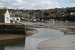
Until the early 1900s, Restronguet Creek and its rivers were very important for the tin and copper mining industry. Devoran was a small port where minerals dug from the ground were sent out. Mining materials and coal were also brought in through this port.
An old industrial railway, called the Redruth and Chasewater Railway, ended at Devoran. This railway served many mines located a few miles north. There were also docks and loading areas at the top of Penpol Creek.
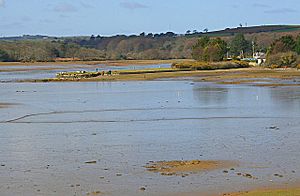
When the tide is low, large areas of mudflats appear. These mudflats can be dangerous because the mud is very deep and soft. Studies show that the mud still contains signs of minerals from the old mining activities further upstream.
Fun Activities at Restronguet Creek
Today, Restronguet Creek, Carrick Roads, and the nearby English Channel coast are popular places for sailing and dinghy racing. The Restronguet Sailing Club is named after the creek, even though it's located a bit further south at Mylor Harbour.
A group called 'The Restronguet Creek Society' was started in 1972. This group is made up of volunteers who work to protect the creek and the area around it. They try to stop building projects that aren't suitable and any activities that might cause more mud to build up in the creek.
Important Places Along the Creek
- The point where the tide stops at Devoran is at coordinates 50°12′47″N 5°05′56″W / 50.21292°N 5.09881°W.
- Penpol Creek, on the north bank, is at coordinates 50°12′24″N 5°04′00″W / 50.206742°N 5.06676°W.
- Restrongruet Passage, on the south bank, is at coordinates 50°11′44″N 5°03′55″W / 50.19553°N 5.06538°W.
- The mouth of the creek, at Restronguet Point, is at coordinates 50°11′32″N 5°03′23″W / 50.19212°N 5.05637°W.
 | William M. Jackson |
 | Juan E. Gilbert |
 | Neil deGrasse Tyson |


