Mynydd y Gaer facts for kids
Quick facts for kids Mynydd y Gaer |
|
|---|---|

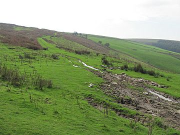
Eastern slopes of Mynydd y Gaer
|
|
| Highest point | |
| Elevation | 295 m (968 ft) |
| Naming | |
| English translation | hill of the fort |
| Language of name | Welsh |
| Geography | |
| Location | Bridgend, Wales |
| OS grid | SS 954858 |
| Topo map | OS Landranger 170 / Explorer 151 |
Mynydd y Gaer is a hill in South Wales. It stands about 295 meters (968 feet) tall. You can find it in the Bridgend area. At the very top, there's a special marker called a trig point. It helps people measure distances and map the land.
Long ago, around 48-50 AD, this hill might have been home to a fort. It belonged to a brave leader named Caradoc. He led the Silures, a local tribe, against the powerful Roman army. Local stories say that Caradoc is buried here. There's a burial mound, or tumulus, on the eastern side. It's even marked on maps today! Other ancient burial mounds are nearby. They are said to be for Meurig and Athwr II. These leaders fought against the Saxons in the 500s.
What Mynydd y Gaer is Made Of
This hill is mostly made of a type of rock called sandstone. This sandstone is part of something called the Pennant Sandstone Formation. These rocks were formed a very long time ago. This was during the Carboniferous Period, which was about 300 million years ago.
The layers of rock here tilt quite steeply. They dip towards the north, into the South Wales Coalfield. You can also find several layers of coal on the hillside. These include the No 1 Rhondda, No 2 Rhondda, Brithdir, and Brithdir Rider coal seams.
How to Visit Mynydd y Gaer
You are allowed to walk freely on the upper parts of Mynydd y Gaer. This is thanks to a law called the Countryside and Rights of Way Act 2000. It means these areas are open access for everyone to enjoy on foot.
There are also special paths you can follow. A public footpath and a byway (a type of track) go up the hill. They start from a car park near the village of Heol-y-Cyw. Both of these paths are part of the Ogwr Ridgeway Walk. You can also find two more public footpaths. These climb the northern side of the hill from the area of Glynogwr.
 | Jackie Robinson |
 | Jack Johnson |
 | Althea Gibson |
 | Arthur Ashe |
 | Muhammad Ali |

