Nahualate River facts for kids
Quick facts for kids Nahualate River |
|
|---|---|
|
Location of mouth
|
|
| Country | Guatemala |
| Physical characteristics | |
| Main source | Guatemala (Sololá, Suchitepéquez) 3,000 m (9,800 ft) Santa Catarina Ixtahuacán 14°52′53″N 91°17′15″W / 14.881253°N 91.287546°W |
| River mouth | Pacific Ocean 0 m (0 ft) 14°02′45″N 91°32′18″W / 14.045877°N 91.538343°W |
| Length | 130 km (81 mi) |
| Basin features | |
| Basin size | 1,941 km2 (749 sq mi) |
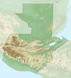
The Río Nahualate is an important river in southwest Guatemala. It starts high up in the mountains, near places like Santa Catarina Ixtahuacán and Nahualá in the Sololá region. From there, it flows south through the flat lands of Suchitepéquez and Escuintla until it reaches the Pacific Ocean.
About the Nahualate River
The Nahualate River is about 130 kilometers (around 80 miles) long. It begins in the Sierra Madre mountains, which are very tall. The river's source is high up, about 3,000 meters (nearly 10,000 feet) above sea level.
Where the River Flows
As the Nahualate River travels, it collects water from a large area called its basin. This basin covers about 1,941 square kilometers (around 750 square miles). The river flows from the mountains, through the coastal lowlands, and finally empties into the Pacific Ocean.
River's Importance
The Nahualate River is a vital water source for the communities along its path. It helps support local farming and provides water for people living in the area.
See also
 In Spanish: Río Nahualate para niños
 | Janet Taylor Pickett |
 | Synthia Saint James |
 | Howardena Pindell |
 | Faith Ringgold |


