Napatree Point facts for kids
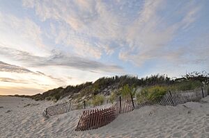
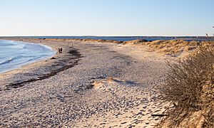
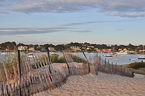
Napatree Point, often called Napatree, is a long, sandy strip of land in Rhode Island. It was formed by natural processes that move sand along the coast. Before a big storm in 1938, Napatree looked like a curved blade and had a long part called Sandy Point.
Today, Napatree stretches about 1.5 miles (2.4 km) from Watch Hill, a village in Westerly, Rhode Island. It helps create a safe harbor. It's also the furthest south and west you can go on mainland Rhode Island.
Contents
What's in a Name?
The name "Napatree" is thought to come from "Nap" or "Nape," meaning "Neck of Trees." This is because Napatree Point used to have many trees. However, a huge storm in 1815, called the Great September Gale of 1815, destroyed all the trees in the area.
Land and Sea
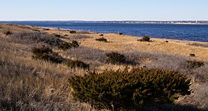
Napatree Point is a thin piece of land, about 1.5 miles (2.4 km) long, located in Block Island Sound. To its north is Little Narragansett Bay, a small area where the Pawcatuck River flows into the ocean. This small bay is connected to the Atlantic Ocean.
This peninsula was partly formed by sand moving along the coast. It also has parts made from material left behind by glaciers, similar to nearby Fishers Island. This whole region of the northeastern United States, shaped by ancient glaciers, is known as the Outer Lands.
A Look Back in Time
In 1898, the government bought about 60 acres (24 ha) of Napatree Point. They wanted to build a fort there to protect the entrance to Long Island Sound and New York City. This fort, called Fort Mansfield, started operating in 1901. But after some practice battles in 1907, it was clear the fort had problems. By 1909, it was no longer used.
In 1926, the government decided to sell the land. A developer wanted to divide Sandy Point into many small building lots. But a group of people from Watch Hill bought the land instead. They wanted to protect their town and prevent many small houses from being built. They bought the land in 1928 and tore down all the fort buildings. Today, only three concrete gun platforms remain. However, the group couldn't keep up with the payments, and in 1931, the land was taken back by the bank.
The Great Hurricane of 1938
The Hurricane of 1938 was a very powerful storm that surprised New England. It caused a lot of damage to homes on Napatree Point. The storm destroyed all the houses there and even one of the old fort's gun platforms. It also created several new openings in the sandy land, called breachways. These openings cut off Sandy Point from the rest of Napatree Point, making Sandy Point an island. Since the 1930s, the Napatree beach has moved back about 200 feet (61 m) due to this hurricane and ongoing erosion from the sea.
In 1940, Sandy Point was given to Alfred Guildersleeve. In 1945, the rest of the land was sold to the Watch Hill Fire District for $10,000.
Napatree Today
Today, Napatree Point is a special place for nature. It's a wildlife preserve and a popular public beach. The Watch Hill Conservancy and Fire District protect the area. They have hired wardens to look after the wildlife and its home. These wardens work with the U.S. Fish and Wildlife Service to protect the piping plover, a bird that is an endangered species.
Napatree is also home to deer, fox, and ospreys. It's also an important resting spot for birds that migrate, meaning they travel long distances between seasons.
 | Delilah Pierce |
 | Gordon Parks |
 | Augusta Savage |
 | Charles Ethan Porter |


