Pawcatuck River facts for kids
Quick facts for kids Pawcatuck River |
|
|---|---|

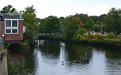
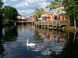
The Pawcatuck River as it flows between Westerly, Rhode Island and Pawcatuck, Connecticut
|
|

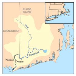
Pawcatuck River watershed
|
|
| Country | United States |
| State | Connecticut / Rhode Island |
| County | New London County, Connecticut Washington County, Rhode Island |
| Physical characteristics | |
| Main source | Worden Pond South Kingstown, Rhode Island 41°26′32″N 71°35′27″W / 41.4423°N 71.5909°W |
| River mouth | Little Narragansett Bay, Long Island Sound Pawcatuck, Connecticut / Westerly, Rhode Island 41°19′N 71°52′W / 41.32°N 71.86°W |
The Pawcatuck River is a river in the United States. It flows for about 34 miles (55 km) through Rhode Island and Connecticut. This river has eight dams along its path. A US Navy ship, the USS Pawcatuck, was named after this river.
Contents
River History and Events
The Pawcatuck River has an interesting past. In 1636, it was chosen as the western border for the Colony of Rhode Island and Providence Plantations. For a time, part of it was even called the Charles River.
A Dolphin's Unexpected Visit
On April 20, 2006, something amazing happened. An Atlantic white-sided dolphin swam several miles up the river! It traveled from Little Narragansett Bay all the way to Westerly, Rhode Island. The dolphin spent hours near the bridge connecting Rhode Island and Connecticut. Hundreds of people gathered to watch this rare sight.
Experts from the Mystic Aquarium thought the dolphin might have gotten separated from its family. It was probably looking for them. Later that night, the dolphin was taken to the aquarium. Sadly, it was already sick, underweight, and bruised from its journey. It died soon after.
The Great Flood of 2010
On March 29, 2010, a huge rainstorm hit New England. The Pawcatuck River overflowed its banks. Water flooded into the towns of Westerly and Pawcatuck. People in low-lying areas had to leave their homes for safety.
Some old buildings were damaged by the floodwaters. For example, a 150-year-old general store in North Stonington was lost. The main bridge in downtown Westerly-Pawcatuck had to be closed for several weeks. Divers had to check it for safety after the water went down.
The River's Path
The Pawcatuck River starts at Worden Pond in South Kingstown, Rhode Island. From there, it generally flows west and southwest. It passes through small villages like Kenyon, Carolina, and Bradford, Rhode Island.
The river also forms a natural border between several towns. It separates Charlestown and Richmond, Rhode Island. It also divides Charlestown and Hopkinton, Rhode Island, and then Hopkinton and Westerly. The river briefly turns northwest and west. Finally, it heads south, flowing past Potter Hill, Rhode Island. It then runs between Westerly, Rhode Island and the Pawcatuck area of Stonington, Connecticut. The Pawcatuck River ends when it flows into Little Narragansett Bay, which is part of Long Island Sound.
River Crossings
Many roads and train tracks cross over the Pawcatuck River. These crossings allow people and trains to travel between the towns on either side of the river. From its start to its end, you can find many bridges and railway lines. For example, the Northeast Corridor (used by Amtrak trains) crosses the river many times. Important roads like RI 2 and U.S. 1 also have bridges over the Pawcatuck.
Rivers and Streams that Feed the Pawcatuck
Many smaller rivers and brooks flow into the Pawcatuck River, making it bigger. These are called tributaries. Some of them include:
- Usquepaug River
- Pusquiset Brook
- Beaver River
- Taney Brook
- White Brook
- Meadow Brook
- Wood River
- Poquiani Brook
- Tomaquag Brook
- McGowan Brook
- Aguntaug Brook
- Ashaway River
- Shunock River
- Mastuxet Brook
 | John T. Biggers |
 | Thomas Blackshear |
 | Mark Bradford |
 | Beverly Buchanan |


