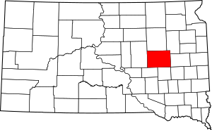
National Register of Historic Places listings in Beadle County, South Dakota facts for kids
Have you ever wondered about the old buildings and places around you? Some places are so special and important that they are added to a list called the National Register of Historic Places. This list helps protect and celebrate buildings, structures, and sites that tell us about the past of the United States.
In Beadle County, South Dakota, there are 27 different places that have been added to this important list. These places include old houses, barns, churches, and even bridges! They help us learn about the history of Beadle County and the people who lived there long ago. You can even see some of these places on a map if their exact location is shared.
Contents
Exploring Historic Buildings in Beadle County
Many of the historic places in Beadle County are buildings that show us how people lived and worked in the past.
Old Homes and Houses
Some houses on the list are special because of their unique design or the important people who lived in them.
- The Faye Bowden-Agnus Saunders House in Huron is one such home. It was built a long time ago and has a story to tell.
- Another interesting house is the Hattie O. and Henry Drake Octagon House, also in Huron. It's called an "octagon house" because it has eight sides, which was a very unusual and modern design when it was built!
- The Margaret and Vernon Maxon House is another historic home in Huron.
- The Pyle House in Huron is also on the list, recognized for its historical value.
Historic Barns and Farms
Farming has always been a big part of life in South Dakota. Several barns and farm-related buildings are recognized for their history.
- The Anderson Barn near Hitchcock is an example of an old farm building that played a role in the area's agricultural past.
- The McMonies Barn in Huron is another historic barn that shows us how farming was done in earlier times.
Community and Religious Buildings
Buildings where people gathered for community events or worship are also important parts of history.
- The Dairy Building in Huron is located near the South Dakota State Fair Grounds. It reminds us of the importance of dairy farming and local fairs.
- The Grace Episcopal Church in Huron is a beautiful old church that has been a place of worship for many years.
- The Chicago and North Western Roundhouse in Huron was a building used to store and repair trains. It tells us about the history of railroads, which were very important for travel and trade.
Historic Districts and Colonies
Sometimes, it's not just one building that's historic, but a whole group of buildings or an entire community. These are called "historic districts" or "colonies."
Campbell Park Historic District
The Campbell Park Historic District of Huron is an area in Huron where many old buildings together create a historic feel. It's like a neighborhood frozen in time, showing how the city looked many years ago.
Hutterite Colonies
Two Hutterite colonies are also on the list. Hutterites are a group of people who live in communities and share many things.
- The Milford Hutterite Colony near Carpenter is recognized for its unique community history.
- The Old Riverside Hutterite Colony near Huron is another example of these historic communities.
Ancient Sites and Bridges
Not all historic places are buildings. Some are much older, like archaeological sites, or important structures like bridges.
Archaeological Sites
Archaeological sites are places where scientists study the remains of past human life. These sites can be very old, showing us how people lived thousands of years ago.
- Archeological Site No. 39BE3 near Wolsey is one such site.
- There are several other archaeological sites listed in Beadle County, including Site 39BE2 near Wessington Springs, and sites like 39BE14, 39BE15, 39BE23, 39BE46, and 39BE48 near Huron.
- Sites like 39BE57 and 39BE64 near Yale also hold clues about ancient life. These sites often have restricted addresses to protect them from damage.
Historic Bridges
Bridges are important structures that connect places and help people travel. Some old bridges are recognized for their engineering or their role in local transportation.
- The South Dakota Dept. of Transportation Bridge No. 03-020-008 near Wessington crosses an unnamed creek.
- The South Dakota Dept. of Transportation Bridge No. 03-327-230 near Cavour crosses Pearl Creek.
- Another bridge, the South Dakota Dept. of Transportation Bridge No. 03-338-100, also near Cavour, crosses Shue Creek. These bridges are examples of older construction methods.
Homestead Claim Shanty
- The Albert S. Piper Homestead Claim Shanty near Carpenter is a small, simple shelter. It represents the early days of settlement when pioneers claimed land to build new lives.
Images for kids


