National Register of Historic Places listings in Bedford County, Pennsylvania facts for kids
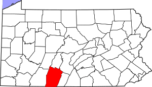
Welcome to Bedford County, Pennsylvania! This page is all about the special places in the county that are listed on the National Register of Historic Places. Think of it like a Hall of Fame for old buildings, sites, and areas that are important to American history and culture.
The National Register of Historic Places is an official list kept by the United States government. It helps protect and celebrate places that tell us about the past. In Bedford County, there are 32 such places! Some of these are even more special and are called National Historic Landmarks, which means they are super important to the whole country.
We'll explore some of these amazing spots and learn why they are so valuable.
Contents
Discovering Bedford County's Historic Gems
Bedford County is full of history, and many of its old buildings and areas are protected. These places help us understand what life was like long ago.
Historic Homes and Buildings
Many old houses and buildings in Bedford County have unique stories. They show us how people lived, worked, and built things in the past.
| Name on the Register | Image | Date listed | Location | City or town | Description | |
|---|---|---|---|---|---|---|
| 1 | Barclay House |
(#78002342) |
230 Juliana Street 40°00′58″N 78°30′14″W / 40.016111°N 78.503889°W |
Bedford | This historic house in Bedford is a great example of old architecture. | |
| 2 | Bedford County Alms House |
(#88002378) |
Cumberland Road, .4 miles (0.64 km) south of Bedford 39°59′13″N 78°32′32″W / 39.986944°N 78.542222°W |
Bedford Township | An old building that once helped people in need. | |
| 3 | Bedford Historic District |
(#83004187) |
Roughly bounded by East, West, and Watson Streets, and the Raystown Branch of the Juniata River 40°01′03″N 78°30′06″W / 40.01750°N 78.501667°W |
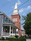
Bedford | This whole area in Bedford is historic, showing how the town grew. | |
| 4 | Bedford Springs Hotel Historic District |
(#84001413) |
U.S. Route 220, south of Bedford 39°59′10″N 78°31′08″W / 39.986111°N 78.518889°W |
Bedford Township | A famous hotel and resort where many important people once stayed. It's a National Historic Landmark! | |
| 5 | Bonnet's Tavern |
(#79002164) |
4 miles (6.4 km) west of Bedford at the junction of U.S. Route 30 and Pennsylvania Route 31 40°02′32″N 78°33′39″W / 40.042222°N 78.560833°W |
Napier Township | An old tavern that served travelers many years ago. | |
| 7 | Chalybeate Springs Hotel |
(#85001560) |
Chalybeate Road, north of Bedford 40°01′34″N 78°28′55″W / 40.026111°N 78.481944°W |
Bedford Township | Another historic hotel known for its natural springs. | |
| 8 | Chestnut Ridge and Schellsburg Union Church and Cemetery |
(#04001482) |
U.S. Route 30 40°02′55″N 78°39′21″W / 40.048611°N 78.655833°W |
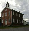
Napier Township | A church and cemetery that have been part of the community for a long time. | |
| 9 | The Coffee Pot |
(#05000097) |
Business Route 30 40°01′23″N 78°31′02″W / 40.022917°N 78.517361°W |
Bedford Township | A unique building shaped like a giant coffee pot! | |
| 10 | Defibaugh Tavern |
(#92001498) |
Northern side of U.S. Route 30, east of Bedford 40°01′34″N 78°27′10″W / 40.026111°N 78.452778°W |
Snake Spring Township | Another old tavern that served travelers on historic routes. | |
| 12 | Dutch Corner Historic Agricultural District |
(#15000533) |
Roughly bounded by Evitts Mountain, the Bedford Township line, the former Dunning Creek Railroad line, and the William Penn Highway 40°06′00″N 78°27′00″W / 40.100000°N 78.450000°W |
Bedford Township | This area shows how farming was done in the past. | |
| 14 | Espy House |
(#74001750) |
123 Pitt Street 40°01′10″N 78°30′11″W / 40.019444°N 78.503056°W |
Bedford | A very important house in Bedford, recognized as a National Historic Landmark. | |
| 15 | Everett Historic District |
(#03000492) |
Roughly bounded by West 5th, Borough, and Hill Streets, River Lane, South Street, and Barndollar Avenue 40°00′41″N 78°22′24″W / 40.011389°N 78.373333°W |
Everett | A historic part of Everett, showing its development over time. | |
| 22 | Juniata Woolen Mill and Newry Manor |
(#83002216) |
West of Everett on Lutzville Road 40°00′44″N 78°25′56″W / 40.012222°N 78.432222°W |
Snake Spring Township | An old mill where wool was processed, along with a historic manor house. | |
| 24 | New Enterprise Public School |
(#81000528) |
Off Pennsylvania Route 869 at New Enterprise 40°10′17″N 78°24′28″W / 40.171389°N 78.407778°W |
South Woodbury Township | This old school building served students in the New Enterprise area. | |
| 27 | Russell House |
(#79002165) |
203 South Juliana Street 40°01′00″N 78°30′12″W / 40.016528°N 78.503333°W |
Bedford | Another significant historic house in Bedford. | |
| 29 | Schellsburg Historic District |
(#01000677) |
Approximately centered on Pitt Street, Market and Baltimore Streets 40°02′52″N 78°38′35″W / 40.047778°N 78.643056°W |
Schellsburg | The historic center of Schellsburg, preserving its old town feel. | |
| 30 | Site 36BD90 |
(#84003102) |
On the grounds of Bedford Village 40°02′31″N 78°30′39″W / 40.042°N 78.5107°W |
Bedford Township | An archaeological site that teaches us about very old human activity in the area. | |
| 32 | Woodvale Historic District |
(#92000942) |
Roughly bounded by Ash, High, North, Fulton, and Broad Streets in Woodvale 40°10′01″N 78°08′17″W / 40.166944°N 78.138056°W |
Broad Top Township | A historic neighborhood that extends into nearby counties.
Historic Bridges and TransportationBridges are important for connecting places. Bedford County has several historic bridges, especially covered bridges, that are still standing. |
|
| 6 | Bridge in Snake Spring Township |
(#88000793) |
Township Road 30 over the Raystown Branch of the Juniata River, east of Bedford 40°00′49″N 78°28′18″W / 40.013611°N 78.471667°W |
Snake Spring Township | An important bridge over the Raystown Branch of the Juniata River. | |
| 11 | Diehls Covered Bridge |
(#80003420) |
South of Schellsburg on Legislative Route 09057, east of New Buena Vista 40°00′34″N 78°38′55″W / 40.009444°N 78.648611°W |
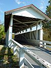
Harrison Township | One of Bedford County's beautiful old covered bridges. | |
| 13 | East Broad Top Railroad |
(#66000666) |
1 mile (1.6 km) west of Orbisonia on U.S. Route 522 40°09′53″N 78°08′16″W / 40.164722°N 78.137778°W |
Broad Top Township | A very important historic railroad, also a National Historic Landmark. It goes into other counties too! | |
| 16 | Feltons Mill Covered Bridge |
(#80003413) |
Legislative Route 05021, east of Bedford 39°58′22″N 78°17′20″W / 39.972778°N 78.288889°W |
East Providence Township | Another well-preserved covered bridge. | |
| 17 | Fischtner Covered Bridge |
(#80003422) |
North of Stringtown off Legislative Route 05007 39°45′49″N 78°45′06″W / 39.763611°N 78.751667°W |
Londonderry Township | This covered bridge is located north of Stringtown. | |
| 18 | Halls Mill Covered Bridge |
(#80003418) |
North of Everett on Township 528 40°07′27″N 78°19′02″W / 40.124167°N 78.317222°W |
Hopewell Township | You can find this covered bridge north of Everett. | |
| 19 | Heirline Covered Bridge |
(#80003419) |
West of Bedford on Legislative Route 05097, north of Manns Choice 40°01′00″N 78°35′37″W / 40.016667°N 78.593611°W |
Harrison and Napier Townships | This bridge connects two townships, Harrison and Napier. | |
| 20 | Hewitt Covered Bridge |
(#80003417) |
Township 305 at Hewitt 39°45′16″N 78°30′40″W / 39.754444°N 78.511111°W |
Southampton Township | Located in Southampton Township, this is another historic covered bridge. | |
| 21 | Jacksons Mill Covered Bridge |
(#80003414) |
Township 412, east of Bedford 39°58′16″N 78°16′19″W / 39.971111°N 78.271944°W |
East Providence Township | You can find Jackson's Mill Covered Bridge east of Bedford. | |
| 23 | Dr. Knisley Covered Bridge |
(#80003411) |
Southeast of Alum Bank on Legislative Route 05098 40°09′36″N 78°36′08″W / 40.16°N 78.602222°W |
West St. Clair Township | This covered bridge is southeast of Alum Bank. | |
| 25 | New Paris Covered Bridge |
(#80003423) |
1 mile (1.6 km) north of New Paris 40°06′58″N 78°38′23″W / 40.116111°N 78.639722°W |
Napier Township | This covered bridge is located north of New Paris. | |
| 26 | Osterburg Covered Bridge |
(#80003421) |
West of Osterburg on Township 757 40°10′37″N 78°32′30″W / 40.176944°N 78.541667°W |
East St. Clair Township | You can find the Osterburg Covered Bridge west of Osterburg. | |
| 28 | Ryot Covered Bridge |
(#80003416) |
South of Alum Bank on Township 559, northwest of Fishertown 40°08′32″N 78°37′30″W / 40.142222°N 78.625°W |
West St. Clair Township | This covered bridge is located south of Alum Bank. | |
| 31 | Snooks Covered Bridge |
(#80003412) |
East of Alum Bank on Township 578 40°10′09″N 78°34′48″W / 40.169167°N 78.58°W |
East St. Clair Township | The Snooks Covered Bridge is east of Alum Bank. |
Places No Longer on the List
Sometimes, a historic place might be removed from the National Register. This can happen if it is destroyed or if it changes too much. Here are two places that were once on the list but are no longer there.
| Name on the Register | Image | Date listed | Date removed | Location | City or town | Summary | |
|---|---|---|---|---|---|---|---|
| 1 | Grand View Point Hotel |
(#97000219) |
|
U.S. Route 30, 17 miles (27 km) west of Bedford, Juniata Township |
Juniata Township | This hotel was built in 1932 but sadly burned down in 2001. | |
| 2 | McDaniels Covered Bridge |
(#80003415) |
|
Address Restricted |
East Providence Township and West Providence Township | This covered bridge was removed from the list in 1988. |


