
National Register of Historic Places listings in Benton County, Iowa facts for kids

This page is all about the amazing and historic places in Benton County, Iowa, that are listed on the National Register of Historic Places. This special list includes buildings, areas, and other spots across the United States that are important because of their history, unique design, or what happened there. Think of it like a hall of fame for old buildings and places!
In Benton County, there are 16 places on this important list. Each one tells a part of the county's story. Let's explore some of them!
Famous Places in Benton County
Benton County Courthouse

The Benton County Courthouse is a grand building in Vinton, Iowa. It was built in 1905 and looks very impressive. The style of the building is called Beaux-Arts Renaissance Classicism. This means it has a fancy, classic look with lots of details, similar to buildings from ancient Greece and Rome. It's where important county decisions are made and where people go for official business.
Old Train Station in Vinton

The Burlington, Cedar Rapids & Northern Passenger Station in Vinton was built in 1900. It's made of stone and brick, and inside, it used to have shiny marble floor tiles and beautiful oak wood. This station was a busy place where people would catch trains. Just a few years after it was built, it became part of the famous Chicago, Rock Island and Pacific Railroad, also known as the Rock Island line. Imagine all the travelers who passed through here!
Herring Hotel: A Stop on the Lincoln Highway

The Herring Hotel in Belle Plaine, Iowa, was built in 1900. This hotel was once a very popular place for travelers. It was known as a "one-stop" spot along the famous Lincoln Highway. The Lincoln Highway was one of the first roads that went all the way across the United States. At the Herring Hotel, people could find a place to sleep, eat good food, enjoy entertainment, and even get their cars serviced. It was a true hub for early road trips!
Unique Round Barns
Benton County is home to some really cool and unusual buildings: round barns! These barns are special because, well, they're round!
James Greer McQuilkin Round Barn
The James Greer McQuilkin Round Barn is located off County Road D65 in Bruce Township. It has an outside made of clay tiles. Round barns were sometimes built because farmers thought they were more efficient. They believed it was easier to feed animals and store hay in a circular building. This barn is even classified as an Iowa Agricultural Experiment Station, which means it was part of studies to improve farming.
Round Barn, Bruce Township Section 3
Another round barn, known as the Round Barn, Bruce Township Section 3, can be found on County Road D56, also in Bruce Township. These unique structures are a reminder of clever farming ideas from the past.
Frank G. Ray House & Carriage House

The Frank G. Ray House & Carriage House is a beautiful home in Vinton, built in the late 1800s. It's designed in the Queen Anne style, which means it has lots of towers, turrets, and decorative details, making it look like a fairytale house! This house was built for Frank G. Ray, who was the secretary of the Iowa Canning Company. The property is also sometimes called "Ray Towers" because of its tall features.
Sankot Motor Company

The Sankot Motor Company building in Belle Plaine is a historic spot related to the early days of cars. Located at 807 13th Street, this building played a part in the history of transportation in the area. It reminds us of a time when cars were becoming popular and new businesses were popping up to sell and fix them.
Vinton Public Library

The Vinton Public Library is an important community building in Vinton. Libraries are special places where everyone can go to read books, learn new things, and connect with their community. This historic building has served the people of Vinton for many years, offering knowledge and a quiet place to explore.
Youngville Cafe

The Youngville Cafe is located in Watkins, Iowa. This cafe was a popular eating spot and a social gathering place for people in the area. Old cafes like this often hold many stories of conversations, meals, and community life.
Historic Districts
Some places on the National Register are not just single buildings, but entire areas called "historic districts." These districts have many buildings that together tell a story about a town's past.
Belle Plaine Main Street Historic District
The Belle Plaine Main Street Historic District includes many buildings along 7th and 9th Avenues and 11th and 13th Streets in Belle Plaine. This area shows what a busy main street looked like in the past, with many old shops and businesses.
Central Vinton Residential Historic District
The Central Vinton Residential Historic District covers a large area in Vinton, roughly bounded by 2nd and D Avenues and W. 13th and W. 6th Streets. This district has many old homes built between the mid-1800s and mid-1900s. Most of these houses still look much like they did when they were first built. The district also includes three old churches that are important for their architecture.
Preston’s Station Historic District
The Preston’s Station Historic District in Belle Plaine is another important area. Located at 402 4th Avenue, this district helps tell the story of how Belle Plaine grew and developed over time.
Images for kids
-
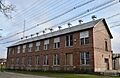
The Iowa Canning Company Seed House Building in Vinton.
-
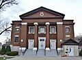
A church within the Central Vinton Residential Historic District.


