Vinton, Iowa facts for kids
Quick facts for kids
Vinton, Iowa
|
|
|---|---|

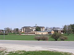
Iowa Braille and Sight Saving School
|
|

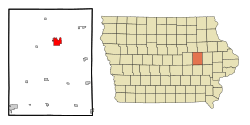
Location of Vinton, Iowa
|
|
| Country | United States |
| State | |
| County | Benton |
| Area | |
| • Total | 4.97 sq mi (12.88 km2) |
| • Land | 4.88 sq mi (12.65 km2) |
| • Water | 0.09 sq mi (0.22 km2) |
| Elevation | 787 ft (240 m) |
| Population
(2020)
|
|
| • Total | 4,938 |
| • Density | 1,010.85/sq mi (390.32/km2) |
| Time zone | UTC-6 (Central (CST)) |
| • Summer (DST) | UTC-5 (CDT) |
| ZIP code |
52349
|
| Area code(s) | 319 |
| FIPS code | 19-81210 |
| GNIS feature ID | 0462580 |
Vinton is a city in Benton County, Iowa, United States. It is also the county seat of Benton County. In 2020, about 4,938 people lived there. Vinton is part of the Cedar Rapids area.
Contents
History of Vinton
Vinton was started in 1849. It was named after Hon. Plynn Vinton, who was a state lawmaker. The first train tracks reached Vinton in 1869. Vinton officially became a city in the same year.
Geography and Nature
Vinton covers about 4.83 square miles (12.51 square kilometers). Most of this area is land, with a small part being water.
The city is located along U.S. Route 218 and the Cedar River. The Cedar River has caused floods in parts of Vinton, most recently in 2008. In 2011, a strong windstorm called a derecho damaged many of the city's trees.
Vinton's Climate
Vinton has a climate with big changes in temperature. Summers are warm, and winters are very cold. It rains or snows throughout the year. Most summer rain comes from thunderstorms. This area is considered humid, meaning it gets enough moisture and is not dry like a desert.
People of Vinton
| Historical population | ||
|---|---|---|
| Year | Pop. | ±% |
| 1870 | 2,460 | — |
| 1880 | 2,906 | +18.1% |
| 1890 | 2,865 | −1.4% |
| 1900 | 3,499 | +22.1% |
| 1910 | 3,336 | −4.7% |
| 1920 | 3,381 | +1.3% |
| 1930 | 3,372 | −0.3% |
| 1940 | 4,163 | +23.5% |
| 1950 | 4,307 | +3.5% |
| 1960 | 4,781 | +11.0% |
| 1970 | 4,845 | +1.3% |
| 1980 | 5,040 | +4.0% |
| 1990 | 5,103 | +1.2% |
| 2000 | 5,102 | −0.0% |
| 2010 | 5,257 | +3.0% |
| 2020 | 4,938 | −6.1% |
| Iowa Data Center Source: U.S. Decennial Census |
||
Vinton's Population in 2020
In 2020, Vinton had 4,938 people living in 2,117 homes. About 28% of these homes had children under 18. The average age in Vinton was 42.2 years old.
Most people in Vinton (about 94.3%) were White. About 1.7% of the population was Hispanic or Latino.
Vinton's Population in 2010
In 2010, Vinton had 5,257 people living in 2,187 homes. About 30.4% of these homes had children under 18. The average age was 40.3 years.
Most people in Vinton (about 97.8%) were White. About 1.0% of the population was Hispanic or Latino.
Education in Vinton
The Vinton-Shellsburg Community School District runs the public schools in Vinton. This school district was formed in 1993.
Vinton was once home to the Iowa Braille and Sight Saving School. This was a special school for students who could not see well. Since 2008, a group called AmeriCorps National Civilian Community Corps (NCCC) has used the Braille School building as its regional office.
Vinton in Movies
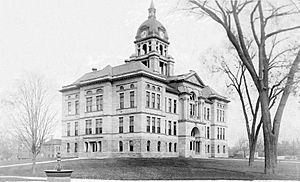
Vinton has been featured in a few movies! Parts of downtown Vinton and the Benton County courthouse were seen in the 1996 film Michael, starring John Travolta. A local church, Prairie Creek Church, also appeared in the movie.
Downtown Vinton was also used as a filming location for the movie "The Final Season."
Famous People from Vinton
Many interesting people have connections to Vinton:
- Desi Druschel: A baseball coach who went to high school in Vinton. He also started his coaching career there.
- James Lorraine Geddes: Born in Scotland, he moved to Vinton before the American Civil War. He became a high-ranking general and later led the Iowa Institution for the Education of the Blind.
- Mary E. Holland: A detective and expert in fingerprints, born in Vinton.
- Mary Ingalls: She was a student at the Iowa College for the Blind (now the Iowa Braille and Sight Saving School) in the 1880s. Her sister, Laura Ingalls Wilder, wrote the famous Little House on the Prairie books.
- Seaman A. Knapp: His farming experiments helped create the U.S. Department of Agriculture's Cooperative Extension System. He considered Vinton his hometown.
- Bing Miller: A professional baseball player and coach. He played for the Philadelphia Athletics and helped them win the 1929 World Series. He was born in Vinton.
- Sally Pederson: She was the 45th lieutenant governor of Iowa. She graduated from Washington High School in Vinton.
- Cato Sells: He was the Commissioner at the Bureau of Indian Affairs from 1913 to 1921. He was born in Vinton.
- Buren R. Sherman: He later became the 12th governor of Iowa. He lived in Vinton from 1863 to 1866. His grave is in Vinton.
- Calvin Pearl Titus: A soldier who received the Medal of Honor for his bravery during the Boxer Rebellion. He was born in Vinton.
- Everett Warner: An artist born in Vinton. He helped design camouflage for the US Navy during both World Wars.
Images for kids
See also

- In Spanish: Vinton (Iowa) para niños
 | Madam C. J. Walker |
 | Janet Emerson Bashen |
 | Annie Turnbo Malone |
 | Maggie L. Walker |


