
National Register of Historic Places listings in Calhoun County, Michigan facts for kids

Welcome to Calhoun County, Michigan! This area is full of amazing places that tell stories about the past. Many of these special spots are listed on the National Register of Historic Places. This list helps protect buildings, sites, and objects that are important to American history, architecture, archaeology, engineering, or culture. Think of it like a Hall of Fame for historic places!
Contents
Exploring Historic Places in Calhoun County
Calhoun County has many unique places that have been saved because of their history. These sites range from old bridges and grand houses to important districts and even a famous sanitarium. Each one helps us understand what life was like long ago.
What is the National Register of Historic Places?
The National Register of Historic Places is the official list of the nation's historic places worth saving. It's managed by the National Park Service. When a place is added to this list, it means it has special historical value. This helps to protect it and makes people more aware of its importance. It's a way to make sure these treasures last for future generations.
Famous Buildings and Bridges
Let's look at some of the cool places in Calhoun County that are on this special list.
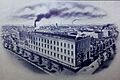
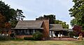
The Battle Creek Sanitarium: A Place of Health
The Battle Creek Sanitarium was once a very famous health resort. It was located at 74 N. Washington Street in Battle Creek. People came from all over to try its unique health treatments. It was founded by John Harvey Kellogg, who was also known for inventing corn flakes! The building is now called the Federal Center. It shows how ideas about health and wellness have changed over time.
_001.jpg)
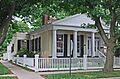
The Unique Honolulu House
In Marshall, you can find the amazing Honolulu House. It's at 107 N. Kalamazoo Street. This house looks like it belongs in Hawaii, not Michigan! It was built in the 1860s by a former U.S. Consul to Hawaii. He wanted to bring a piece of the islands back home. The house is part of the Marshall Michigan Historic Landmark District. It's a great example of unusual architecture.

W. K. Kellogg's Home
Did you know that W. K. Kellogg, the cereal pioneer, had a house in Battle Creek? The W. K. Kellogg House was originally at 256 W. Van Buren Street. In 1990, it was carefully moved to its current spot at 1 Monroe Street. This house reminds us of the person who helped change breakfast forever.

The Old Cortright-Van Patten Mill
The Cortright-Van Patten Mill was a historic mill located at 109 Byron Street in Homer. It was a working mill until the 1970s. Sadly, this old building completely burned down in a fire on May 16, 2010. Before the fire, it had been used as a dinner theater and a restaurant. It's a reminder that even historic places can be lost.

Pine Creek Potawatomi Reservation: A Special Place
The Pine Creek Indian Reservation, also known as the Pine Creek Potawatomi Reservation, is a culturally important site. It's located at 1485 Mno-Bmadzewen Way near Fulton. This area is significant to the Nottawaseppi Huron Band of Potawatomi people. It helps preserve their history and traditions.

Historic Bridges of Calhoun County
Calhoun County is also home to several historic bridges. These bridges are important examples of old engineering.
- The 12 Mile Road-Kalamazoo River Bridge crosses the Kalamazoo River near Marshall. It was built to help people travel across the river.
- The 23 Mile Road-Kalamazoo River Bridge is another historic bridge over the Kalamazoo River, located near Marengo.
- The Marshall Avenue Bridge in Marshall crosses Rice Creek. These bridges show how people built important connections for transportation long ago.


Why are These Places Important?
These historic places in Calhoun County are like open-air museums. They teach us about the past, how people lived, and how our communities grew. By protecting them, we make sure that these stories and lessons are available for everyone, including you, to learn from and enjoy for many years to come!
Images for kids
-
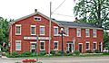
Advent Historic District
-
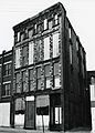
Adam C. Arnold Block (now demolished)
-
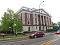
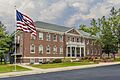
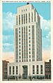
Battle Creek City Hall
-
Old Battle Creek Post Office
-

Boys' Club Building
-
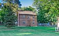
Harold C. Brooks House, also known as the Jabez S. Fitch House.
-

James and Anne Atmore Bryant Farmstead
-
Camp Custer Veterans Administration Hospital
-
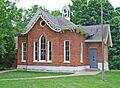
Capitol Hill School
-
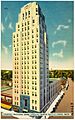
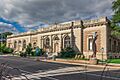
Central National Tower
-

City Hall Historic District
-
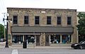
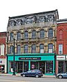
The Emporium in Marshall.
-
Gardner House
-
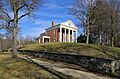
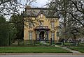
Governor's Mansion in Marshall.
-
Homer Village Historic District
-
Joy House
-

Isaac Lockwood House
-
Maple Street Historic District
-
Masonic Temple Building
-
Merritt Woods Historic District
-
National House
-

Oakhill
-
Old-Merchants National Bank and Trust Co. Building (Heritage Tower)
-
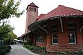
Penn Central Railway Station
-
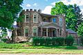
Penniman Castle
-
William Prindle Livery Stable
-
Record Printing and Box Company Building
-
Eugene P. Robertson House
-
Stonehall
-
Stow-Hasbrouck House
-
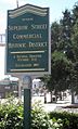
Superior Street Commercial Historic District
-
Van Buren Street Historic District
-
Wagner's Block
-
Frank and Dorothy Ward House
-
Wright-Brooks House


.jpg)


