National Register of Historic Places listings in Cecil County, Maryland facts for kids
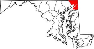
This article is about special places in Cecil County, Maryland, that are listed on the National Register of Historic Places. This register is like a national list of buildings, sites, and objects that are important in American history, architecture, archaeology, engineering, or culture. When a place is on this list, it means it's recognized for its unique story and value to the country.
Cecil County has 51 places on this important list. These places include old houses, churches, mills, and even archaeological sites. They help us learn about the past and understand how people lived long ago in Maryland.
Contents
What is the National Register of Historic Places?
The National Register of Historic Places is the official list of the nation's historic places worth saving. It's part of a program by the United States government to help protect important historical sites. Being on the list doesn't mean a place is a museum, but it does mean it's recognized as special. It can also help with getting grants or tax benefits for preserving these sites.
Why are these places important?
These historic places tell us stories about the past. They show us how people lived, worked, and built things many years ago. For example, some places might have been important during wars, while others might show how farming or industries developed. By protecting them, we make sure future generations can also learn from these valuable pieces of history.
Exploring Historic Sites in Cecil County
Cecil County is full of interesting historic spots. Let's look at a few examples of the kinds of places you can find on the National Register here.
Old Buildings and Homes
Many of the listed places are old homes and buildings. These structures often show different styles of architecture from the past.
Bohemia Farm
Bohemia Farm is one of the oldest places on the list, added in 1973. It's located near Earleville, Maryland. Imagine a farm that has been around for hundreds of years, telling stories of many families who lived and worked there.
Jeremiah Brown House and Mill Site
Near Rising Sun, Maryland, you can find the Jeremiah Brown House and Mill Site. This place includes an old house and the remains of a mill. Mills were super important long ago for grinding grain into flour, which was a basic food. This site helps us understand early industries.
Holly Hall
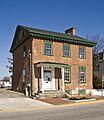
In Elkton, Maryland, there's a place called Holly Hall. It's a beautiful old building that was added to the register in 1976. Many of these old homes were once grand estates or important family residences.
Historic Districts and Towns
Sometimes, a whole area or town is considered historic because many of its buildings together tell a story.
Charlestown Historic District
Charlestown, Maryland, has its own historic district. This means that a whole section of the town is recognized for its historical importance. Walking through a historic district is like stepping back in time, seeing how towns were laid out and what buildings looked like centuries ago.
Port Deposit Historic District
Port Deposit, Maryland, also has a historic district. This town is special because it's located right on the Susquehanna River. Its history is tied to the river and the industries that grew up around it.
Industrial and Transportation History
Some sites on the list show how people worked and traveled in the past.
Principio Furnace
The Principio Furnace near Perryville, Maryland, is a very important historical site. It was one of the earliest ironworks in America, starting way back in the 1700s! This furnace played a big role in the early industrial growth of the country.
New Castle and Frenchtown Railroad Right-of-Way
This site is part of an old railroad line that connected New Castle, Delaware, to Frenchtown in Maryland. This railroad was one of the earliest in the United States and helped transport goods and people. It shows how transportation changed over time.
Old Lock Pump House, Chesapeake and Delaware Canal
In Chesapeake City, Maryland, you can see the Old Lock Pump House, Chesapeake and Delaware Canal. This building was part of the Chesapeake and Delaware Canal, a waterway that helped ships travel between the Chesapeake Bay and the Delaware River. The pump house helped manage the water levels in the canal.
Archaeological Sites
Some places on the list aren't buildings at all, but archaeological sites. These are places where scientists study artifacts and remains from ancient times.
Bumpstead Archeological Site
The Bumpstead Archeological Site is an example of a place where archaeologists might find clues about how Native Americans lived thousands of years ago. These sites are often kept secret to protect them from damage.
Heath Farm Jasper Quarry Archeological Site
This site is a quarry where ancient people dug for jasper, a type of stone. They used this stone to make tools and weapons. Learning about these quarries helps us understand how early humans used natural resources.
Lighthouses and Schools
Other unique structures also make the list.
Turkey Point Light Station
The Turkey Point Light Station is a lighthouse located in Elk Neck State Park. Lighthouses were essential for guiding ships safely along the coast and rivers before modern navigation. This one has stood tall for many years, watching over the waters.
Tome School for Boys Historic District
The Tome School for Boys Historic District in Port Deposit, Maryland, was once a famous school. It shows how education was provided in the past and the grand buildings that were sometimes built for learning.
Images for kids


