
National Register of Historic Places listings in Davis County, Utah facts for kids

This article is about special places in Davis County, Utah, that are listed on the National Register of Historic Places. This list includes buildings, areas, and other sites that are important to the history of the United States. By putting them on this list, people can help protect them for future generations.
Contents
What is the National Register of Historic Places?
The National Register of Historic Places is like a special list of important historical places in the U.S. It's managed by the National Park Service. When a place is added to this list, it means it has a unique story or design that tells us about the past. This helps people understand and protect these valuable sites.
In Davis County, Utah, there are 61 different places on this list. These include old homes, churches, and even parts of an amusement park! A few other places were once on the list but have since been removed.
Historic Places in Davis County
Davis County has many interesting places that tell stories from long ago. Let's explore some of them!
Homes with History
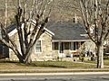
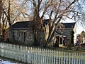
Many old houses in Davis County are on the National Register. These homes often show us how people lived and built houses many years ago.
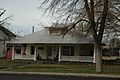
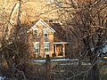
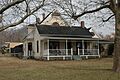
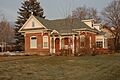
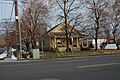
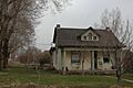
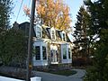
- The Joseph Adams House in Layton was built a long time ago. It's a great example of early homes in the area.
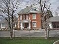
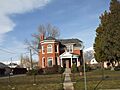
- In Kaysville, you can find the Henry Blood House. Henry Blood was a very important person; he used to be the Governor of Utah. His home is a reminder of his life and work.
- The Joseph and Ann Hill Cabin in Layton is a very old cabin. It shows us what early pioneer homes might have looked like.
- The Smoot Dairy Farmhouse in Centerville is another historic home. It reminds us of the farming history in the county.
Fun and Games: Lagoon Amusement Park
Did you know that parts of Lagoon Amusement Park in Farmington are also historic? These rides are very old and special!
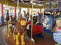
- The Lagoon Carousel was built in 1913. This beautiful ride has hand-carved animals and has been at Lagoon since 1918. Imagine riding a carousel that's over 100 years old!
- The Lagoon Flying Scooter was installed in 1941. It's now known as the Flying Aces. This ride has been making people happy for many decades.
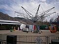
- The Lagoon Roller Coaster is one of the oldest roller coasters in the world! It has been thrilling visitors at Lagoon since 1921. It's amazing that such an old ride is still working today.
Other Important Buildings
Besides homes and amusement park rides, other types of buildings are also protected.
- The Bountiful Tabernacle in Bountiful is a beautiful and historic church building. It has been an important part of the community for a long time.
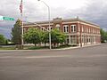
- The Farmer's Union Building and the First National Bank of Layton in Layton show us what old businesses and banks looked like. They tell us about how people used to shop and manage money.
- The Farmington Tithing Office in Farmington is another interesting historical building. It was used by the early settlers for community purposes.
- The VanFleet Hotel in Farmington was once a busy hotel. It reminds us of how travelers used to stay when visiting the area.
Why are These Places Important?
These historic places are important for many reasons. They help us learn about the past and understand how our communities grew. They show us different styles of architecture and how people lived their daily lives. Protecting these sites means we can keep their stories alive for everyone to learn from and enjoy.
Images for kids
-
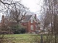
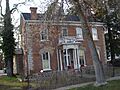
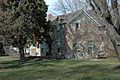
The Joseph Adams House in Layton.
-
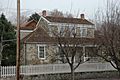
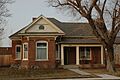
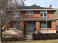
The James and Hannah Atkinson House in Woods Cross.
-
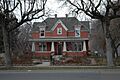
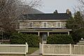
The Barnard-Garn-Barber House in Centerville.
-
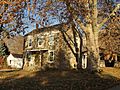
The John George Moroni Barnes House in Kaysville.
-
The John R. Barnes House in Kaysville.
-
The Henry Blood House, home of a former Utah Governor.
-
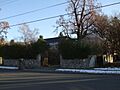
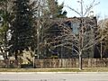
A view of the Bountiful Historic District.
-
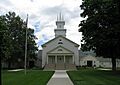
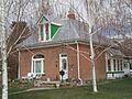
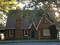
The historic Bountiful Tabernacle.
-
The Thomas and Margaret Brandon House in Centerville.
-
The William Capener House in Centerville.
-
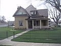
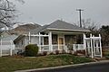
A home in the Clark Lane Historic District in Farmington.
-
The Osmyn and Emily Deuel House in Centerville.
-
The John, Harriet, and Eliza Jennett Duncan House in Centerville.
-
The James and Jane Eldredge House in West Bountiful.
-
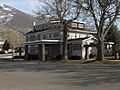
The Farmer's Union Building in Layton.
-
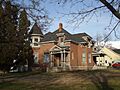
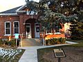
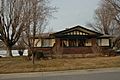
A building in the Farmington Main Street Historic District.
-
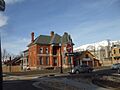
The Farmington Tithing Office.
-
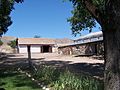
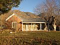
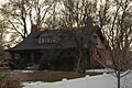
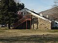
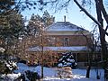
The Fielding Garr Ranch on Antelope Island.
-
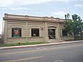
The First National Bank of Layton.
-
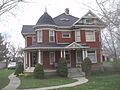
The Joseph N. and Algie Ford House in Centerville.
-
The Ford-Rigby House in Centerville.
-
The James Green House in Bountiful.
-
The Hector C. Haight House in Farmington.
-

The Thomas and Caroline Harris House in Centerville.
-
The Harris-Tingey House in Centerville.
-
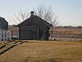
The Joseph and Ann Hill Cabin in Layton.
-
The Holland-Smith-Brown House in Centerville.
-
The Kilbourn-Leak House in Centerville.
-

The George Quincy Knowlton House in Farmington.
-
The Lagoon Carousel.
-
The Lagoon Flying Scooter, also known as Flying Aces.
-
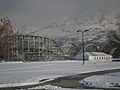
The historic Lagoon Roller Coaster.
-
The George W. Layton House in Layton.
-
The John Henry Layton House in Layton.
-
The Mills-Hancock House in Centerville.
-
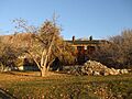
The Nathan and Rebecca Cherry and Eliza Ford Porter Farmstead.
-
The Nathan T. and Anna Porter House in Centerville.
-
The Melvin Harley Randall House in Centerville.
-
The Rich-Steeper House in Centerville.
-
The Richards House in Farmington.
-
The B.H., Louisa Smith and Cecilia Dibble Roberts House.
-
The Thomas J. and Amanda N. Smith House in Kaysville.
-
The Smith-Larsen House in Centerville.
-
The Smoot Dairy Farmhouse.
-
The Stayner-Steed House in Farmington.
-
The LeConte Stewart House in Kaysville.
-
The William Henry and Mary Streeper House in Centerville.
-
The John W., Janet (Nettie), and May Rich Taylor House.
-
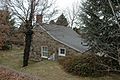
The Thurston-Chase Cabin in Centerville.
-
The Thomas Tingey House in Centerville.
-
The VanFleet Hotel in Farmington.
-
The Franklin and Amelia Walton House in Centerville.
-
The John and Sarah Jane Wayman House in Centerville.
-
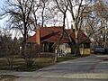
A view of the West Bountiful Historic District.
-
The Thomas and Elizabeth Mills Whitaker House in Centerville.
-
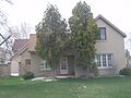
The James D. Wilcox House in Farmington.
-
The Young Men's Hall – Tingey House (a former listing).


