
Farmington, Utah facts for kids
Quick facts for kids
Farmington, Utah
|
|
|---|---|

The new City Hall, built in 2010
|
|

Location in Davis County and the state of Utah
|
|
| Country | United States |
| State | Utah |
| County | Davis |
| Settled | 1847 |
| Incorporated | February 18, 1852 |
| Founded by | Hector Caleb Haight |
| Named for | Farming |
| Area | |
| • Total | 10.05 sq mi (26.02 km2) |
| • Land | 9.95 sq mi (25.78 km2) |
| • Water | 0.09 sq mi (0.24 km2) |
| Elevation | 4,246 ft (1,294 m) |
| Population
(2020)
|
|
| • Total | 24,531 |
| • Density | 2,465/sq mi (951.6/km2) |
| Time zone | UTC−7 (Mountain (MST)) |
| • Summer (DST) | UTC−6 (MDT) |
| ZIP code |
84025
|
| Area code(s) | 385, 801 |
| FIPS code | 49-24740 |
| GNIS feature ID | 2410488 |
Farmington is a city in Utah, United States. It is the main city, or county seat, of Davis County. In 2020, about 24,531 people lived here.
Farmington is home to the famous Lagoon Amusement Park. It also has Station Park, a shopping and entertainment area. You can even catch a train at the FrontRunner train station there!
Contents
History of Farmington
The area where Farmington is now was first settled in 1847. The Haight family, who were Mormon pioneers, started a farm and an inn. More families moved here in 1849.
This new community was first called North Cottonwood Settlement. In 1852, it was officially named Farmington. It also became the county seat. In 1853, people in Farmington built a wall around the city. This was to protect the town and was known as "the Fort."
Early church meetings were held in a log school. Later, they used an adobe building. From 1855 to 1863, the county courthouse was used for religious meetings. The first special church building was opened in 1864. By the early 1860s, Farmington stretched for six miles.
The Children's Primary Association was started here in 1878. This group is part of the Church of Jesus Christ of Latter-day Saints. LeGrand Richards, a well-known church leader, was born in Farmington. His great-grandfather, Joseph Lee Robinson, was the first bishop of the area.
Lagoon Amusement Park opened in Farmington in 1886. It covers about 100 acres (0.4 km²) of the city. Ezra T. Clark was an early settler. He started the Davis County Bank. He also built many houses in the area. Some of these houses are now part of a historic district.

Geography and Climate
Farmington is in the eastern part of Davis County. To the north are Kaysville and Fruit Heights. To the south is Centerville. The Wasatch Mountains are to the east. The Great Salt Lake is to the west.
The city covers about 10.0 square miles (25.8 km²). Most of this is land, with a small amount of water.
Farmington's Weather
Farmington often gets a lot of snow in winter. This is because of the nearby Great Salt Lake. In summer evenings, cool breezes come down from the mountains.
Farmington has a climate that is like a Mediterranean climate. This means it has hot, dry summers and mild, wet winters. However, it's not on the coast like most Mediterranean climates. It can also be seen as a humid continental climate.
| Climate data for Farmington, Utah (1981–2010) | |||||||||||||
|---|---|---|---|---|---|---|---|---|---|---|---|---|---|
| Month | Jan | Feb | Mar | Apr | May | Jun | Jul | Aug | Sep | Oct | Nov | Dec | Year |
| Mean daily maximum °F (°C) | 38.1 (3.4) |
43.7 (6.5) |
53.3 (11.8) |
62.8 (17.1) |
71.2 (21.8) |
81.6 (27.6) |
91.5 (33.1) |
90.5 (32.5) |
80.0 (26.7) |
66.1 (18.9) |
50.3 (10.2) |
39.3 (4.1) |
64.0 (17.8) |
| Mean daily minimum °F (°C) | 21.6 (−5.8) |
25.8 (−3.4) |
31.3 (−0.4) |
38.0 (3.3) |
45.7 (7.6) |
52.7 (11.5) |
62.9 (17.2) |
61.5 (16.4) |
52.0 (11.1) |
40.0 (4.4) |
30.4 (−0.9) |
22.7 (−5.2) |
40.4 (4.6) |
| Average precipitation inches (mm) | 2.07 (53) |
2.01 (51) |
2.30 (58) |
2.44 (62) |
2.05 (52) |
1.25 (32) |
0.70 (18) |
0.99 (25) |
1.12 (28) |
1.72 (44) |
2.10 (53) |
1.97 (50) |
20.72 (526) |
| Average snowfall inches (cm) | 13.8 (35) |
11.0 (28) |
5.8 (15) |
2.3 (5.8) |
0.0 (0.0) |
0.0 (0.0) |
0.0 (0.0) |
0.0 (0.0) |
0.0 (0.0) |
0.3 (0.76) |
5.7 (14) |
14.7 (37) |
53.6 (135.56) |
| Source: NOAA | |||||||||||||
People of Farmington
| Historical population | |||
|---|---|---|---|
| Census | Pop. | %± | |
| 1860 | 591 | — | |
| 1870 | 976 | 65.1% | |
| 1880 | 1,073 | 9.9% | |
| 1890 | 1,036 | −3.4% | |
| 1900 | 1,050 | 1.4% | |
| 1910 | 1,280 | 21.9% | |
| 1920 | 1,170 | −8.6% | |
| 1930 | 1,339 | 14.4% | |
| 1940 | 1,211 | −9.6% | |
| 1950 | 1,468 | 21.2% | |
| 1960 | 1,951 | 32.9% | |
| 1970 | 2,526 | 29.5% | |
| 1980 | 4,691 | 85.7% | |
| 1990 | 9,028 | 92.5% | |
| 2000 | 12,081 | 33.8% | |
| 2010 | 18,275 | 51.3% | |
| 2020 | 24,531 | 34.2% | |
| 2023 (est.) | 25,771 | 41.0% | |
| U.S. Decennial Census | |||

Farmington is part of a larger city area called the Ogden–Clearfield Metropolitan Statistical Area. In 1850, many of the people living in Farmington were from New York.
In 2020, there were 24,531 people in Farmington. Most people (about 88.6%) were White. About 5.4% of the people were Hispanic or Latino.
The population was almost equally split between males and females. About 34.8% of the people were under 18 years old. The average age was 31.7 years.
There were about 7,150 households in Farmington. An average household had 3.43 people. Most households (81.1%) were families. About 47.8% of all households had children under 18. Most homes (79.0%) were owned by the people living in them.
The average income for a household in Farmington was about $99,208. For families, it was about $111,116. Only a small number of people (3.5%) lived below the poverty line.
Most adults in Farmington have a high school diploma or more education. Many have gone to college or earned a degree.
Arts and Culture
The S&S Shortline Railroad Park and Museum is in the Farmington area. It has over 90 pieces of old railroad equipment. You can even ride trains there! Train rides are offered on the first Saturday of each month from June to September. The museum has trains of different sizes. One cool item is a small, oil-powered steam train.
Parks and Recreation
Farmington has a great trail system. The Farmington Trail Committee takes care of over 146 miles (235 km) of trails. There are 36 named trails that go from the hills in the east to the wetlands in the west. The trails are made of different materials like gravel, asphalt, and concrete. You can reach 55 interesting spots using these trails.
Education
The Davis School District serves the community of Farmington. This district is in charge of the schools in the area.
Notable People
- Henry McBride – He was the fourth governor of Washington state.
- LeGrand Richards – A well-known religious leader.
- Bruce Summerhays – A professional golfer on the Champions Tour.
- Daniel Summerhays – A professional golfer on the PGA Tour.
- Obert C. Tanner – He founded the company O.C. Tanner Co..
Images for kids
-
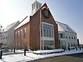
The new City Hall, built in 2010
-

Location in Davis County and the state of Utah
See also
 In Spanish: Farmington (Utah) para niños
