National Register of Historic Places listings in La Paz County, Arizona facts for kids
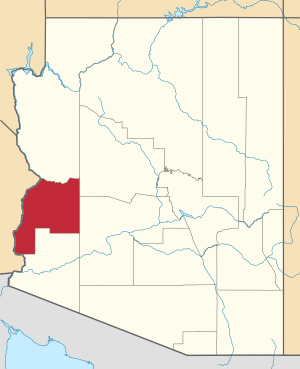
This is a list of the National Register of Historic Places listings in La Paz County, Arizona.
This is intended to be a complete list of the properties and districts on the National Register of Historic Places in La Paz County, Arizona, United States. The locations of National Register properties and districts for which the latitude and longitude coordinates are included below, may be seen in a map.
There are 10 properties and districts listed on the National Register in the county.
Current listings
| Name on the Register | Image | Date listed | Location | City or town | Description | |
|---|---|---|---|---|---|---|
| 1 | Eagletail Petroglyph Site |
(#88001570) |
Address Restricted |
Hyder | ||
| 2 | Harquahala Mountain Smithsonian Solar Observatory Historic District |
(#97000346) |
Harquahala Mountain (Wilderness), southwest of Gladden Coordinates missing |
Gladden | ||
| 3 | Harquahala Peak Observatory |
(#75000370) |
East of Wenden off U.S. Route 60 33°48′48″N 113°20′44″W / 33.813333°N 113.345556°W |
Wenden | ||
| 4 | Hi Jolly Monument |
(#11000054) |
North end of Cemetery Rd. 33°39′52″N 114°14′11″W / 33.664444°N 114.236389°W |
Quartzsite | Pyramidal Monuments in Arizona MPS | |
| 5 | Rhoda Nohlechek House |
(#96000529) |
Northwestern corner of the junction of 2nd St. and Date Ave. 33°49′24″N 113°32′27″W / 33.823333°N 113.540833°W |
Wenden | ||
| 6 | Old La Paz |
(#70000117) |
Address Restricted |
Ehrenberg | ||
| 7 | Old Presbyterian Church |
(#71000122) |
Southwest of Parker on 2nd Ave. 34°06′45″N 114°18′48″W / 34.1125°N 114.313333°W |
Parker | ||
| 8 | Parker Jail |
(#75000369) |
Northern side of Agency Rd. in Pop Harvey Park 34°08′55″N 114°17′39″W / 34.148611°N 114.294167°W |
Parker | ||
| 9 | Poston Elementary School, Unit 1, Colorado River Relocation Center |
(#12001010) |
Poston Rd. 0.4 miles (0.64 km) west of Mohave Rd. 33°59′40″N 114°24′24″W / 33.994444°N 114.406667°W |
Parker | Elementary school at Poston War Relocation Center | |
| 10 | Ripley Intaglios |
(#75000368) |
Address Restricted |
Ehrenberg |

All content from Kiddle encyclopedia articles (including the article images and facts) can be freely used under Attribution-ShareAlike license, unless stated otherwise. Cite this article:
National Register of Historic Places listings in La Paz County, Arizona Facts for Kids. Kiddle Encyclopedia.


