
National Register of Historic Places listings in Madison County, New York facts for kids

Did you know that many old buildings, places, and even parts of canals in Madison County, New York, are super important to history? They are listed on something called the National Register of Historic Places. This special list helps protect these places so future generations can learn from them and enjoy them. It's like a hall of fame for historic sites across the United States!
In Madison County, there are many cool spots on this list. Some are even more special and are called National Historic Landmarks. These are places that are important to the history of the entire country, not just the county or state!
Exploring Historic Places in Madison County
Madison County is full of amazing historical sites, from old farmhouses to important canals. Let's take a look at some of these special places that tell us stories about the past.
Important National Historic Landmarks
Three places in Madison County are so important that they are called National Historic Landmarks. This means they played a big role in American history!
The New York State Canal System
One of these landmarks is a part of the New York State Canal System. This includes parts of the famous Erie Canal and other waterways. Imagine a time before cars and trains, when canals were like superhighways for boats! They helped move goods and people all across New York. This canal system was a huge deal in the early 1900s, helping New York grow and connect with other parts of the country.
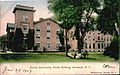
Oneida Community Mansion House
Another super important place is the Oneida Community Mansion House in Oneida. This large building was once home to the Oneida Community, a group of people who lived together and shared everything. They were famous for making silverware and other things. It's a fascinating example of a unique way of life from the past.
Gerrit Smith Estate
The Gerrit Smith Estate in Peterboro is also a National Historic Landmark. Gerrit Smith was a very important person in American history. He was a leader in the movement to end slavery and helped many people escape to freedom. His home was a safe place for those seeking freedom, and he worked hard for equal rights for everyone.
Historic Buildings and Districts
Besides the National Historic Landmarks, many other places in Madison County are on the National Register. These include old homes, churches, and even whole neighborhoods!
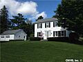
Historic Homes and Farms
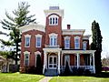
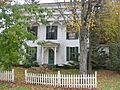
You'll find many old farmhouses and homes on the list, especially around Cazenovia. Places like the Abell Farmhouse and Barn, Annas Farmhouse, and the Cobblestone House show us how people lived and worked long ago. These buildings often have unique designs and tell us about the architecture of the past.
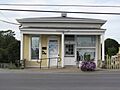
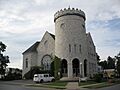
Churches and Public Buildings
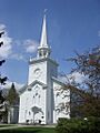
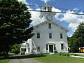
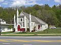
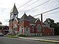
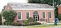
Many historic churches are also listed, like the Canastota Methodist Church and the Fenner Baptist Church. These buildings often have beautiful architecture and were important gathering places for communities. Public buildings like the Canal Town Museum in Canastota and the Morrisville Public Library also hold special historical value. The Old Madison County Courthouse in Morrisville is another example of a building that played a big role in the county's history.
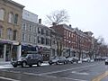
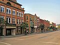
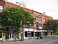
Historic Districts
Sometimes, not just one building, but a whole area is considered historic! These are called "historic districts." For example, the Albany Street Historic District and the Cazenovia Village Historic District protect entire neighborhoods with many old and important buildings. Walking through these districts is like stepping back in time!
Other Notable Sites
There are many other interesting places on the list:
- The Chittenango Landing Dry Dock Complex was a place where boats on the old Erie Canal could be repaired.
- The Peterboro Land Office is a reminder of how land was settled and sold long ago.
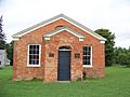
- The Lenox District No. 4 Schoolhouse, now the Clockville Town Hall, was once a small school where children learned.
These are just some of the many amazing historic places in Madison County. Each one has a story to tell about the people and events that shaped this area. Visiting them is a great way to connect with history!
Images for kids
-
Albany Street Historic District in Cazenovia
-
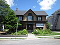
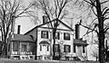
Annas Farmhouse
-
Canal Town Museum
-
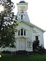
Canastota Methodist Church
-
First Presbyterian Church in Cazenovia Village Historic District
-
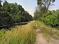
A portion of the Chenango Canal Summit Level
-
Coolidge Stores Building
-
Earlville Historic District
-
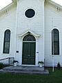
Fenner Baptist Church
-
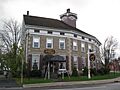
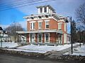
First National Bank of Morrisville
-
Hamilton Village Historic District
-
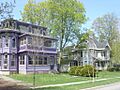
Farnam Mansion in the Main-Broad-Grove Streets Historic District
-
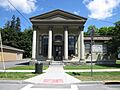
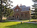
Morrisville Public Library
-
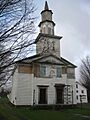
Nelson Welsh Congregational Church
-
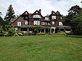
Notleymere
-
Old Biology Hall at Colgate University
-
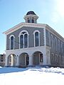
Old Madison County Courthouse
-
Oneida Community Mansion House
-
Peterboro Land Office
-
Peterboro Street Elementary School
-
Judge Nathan S. Roberts House
-
Seventh Day Baptist Church
-
Adon Smith House
-
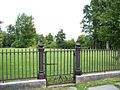
Gate at the Gerrit Smith Estate
-
Smithfield Presbyterian Church
-
South Peterboro Street Commercial Historic District
-
Spirit House
-
St. Paul's Church
-
United Church of Canastota
-
US Post Office-Hamilton


.jpg)


