
National Register of Historic Places listings in Marion County, Missouri facts for kids

Welcome to Marion County, Missouri! This area in the United States is full of amazing history. Many special places here are listed on the National Register of Historic Places. This is like a national list of important buildings, areas, and sites that tell us about the past.
There are 41 different properties and historic districts in Marion County on this list. One of them is even more special: it's a National Historic Landmark! These landmarks are extra important to the history of the whole country.
What is the National Register of Historic Places?
The National Register of Historic Places, or NRHP, is the official list of places in the U.S. that are worth saving. It's like a special club for buildings, neighborhoods, and other sites that have a big story to tell. These places might be important because of their history, their amazing design, or because of famous people who lived or worked there.
When a place is added to the NRHP, it means it's recognized for its value. This helps protect it and encourages people to learn about its past. It also means that certain rules apply to make sure these historic treasures are kept safe for future generations.
Historic Treasures in Marion County
Marion County is home to many fascinating places on the National Register. These sites are found in cities like Hannibal, Missouri and Palmyra, Missouri. They include everything from old houses and churches to entire neighborhoods and even a baseball field!
Famous Homes and Buildings
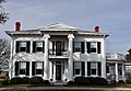
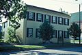
Many historic homes are on the list. For example, the Levi Barkley House near Hannibal is a historic home. The Dryden-Louthan House and Peter J. Sowers House in Palmyra are also recognized for their history. These houses show us how people lived long ago.
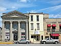
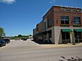
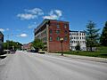
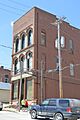
Other important buildings include the Davidson Building and the Digel Block in Hannibal. These were likely important for businesses or community life in the past. The Federal Building in Hannibal, built in 1980, is another example of a significant public building.
Historic Districts: Stepping Back in Time
Some parts of Marion County are so historic that whole areas are listed as "historic districts." This means many buildings in that area are important together.
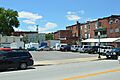
- The Broadway District in Hannibal is one such area.
- The Central Park Historic District is another, showing how neighborhoods looked and felt in earlier times.
- The Mark Twain Historic District is especially famous. It includes places connected to the famous author Mark Twain, whose real name was Samuel Clemens.
Sports and Landmarks: Clemens Field
Did you know a baseball field can be historic? Clemens Field in Hannibal is on the list! It's a place where many games have been played and memories made. It's cool to think about how sports history is also preserved.
Important Public Buildings
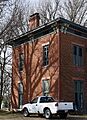
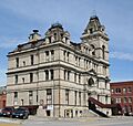
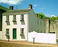
The Marion County Courthouse in Hannibal is a grand building where important decisions have been made for the county. Also, the Marion County Jail and Jailor's House in Palmyra tells us about the justice system from long ago. These buildings show how communities were organized.
The Mark Twain Boyhood Home: A National Treasure
The most famous site in Marion County on the National Register is the Mark Twain Boyhood Home in Hannibal. This house is so important that it's a National Historic Landmark. This is where Samuel Clemens, who later became Mark Twain, grew up. He wrote famous books like The Adventures of Tom Sawyer and Adventures of Huckleberry Finn. Visiting his boyhood home helps us imagine what his life was like and how it inspired his stories.
Other Unique Sites
There are also interesting sites like the Lock and Dam No. 21 Historic District on the Mississippi River. This shows how people managed the river for travel and trade. The Rockcliffe Mansion in Hannibal is another impressive home, recognized for its beautiful architecture.
Even parks are on the list! Riverview Park in Hannibal is a historic park, offering beautiful views and a connection to the past.
Why are These Places Important?
These historic places are like windows into the past. They help us understand how people lived, worked, and built communities many years ago. By preserving them, we keep history alive and make sure that future generations can learn from and enjoy these special sites. They are a big part of Marion County's identity and heritage.
Images for kids
-
Broadway District
-
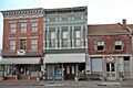
Buildings at 207-209 South Main St.
-
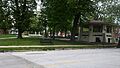
Central Park Historic District
-
Clemens Field
-
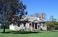
Culbertson-Head Farmstead
-
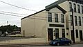
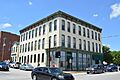
Davidson Building
-
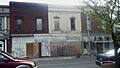
Digel Block
-
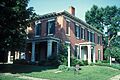
Dryden-Louthan House
-
Ebert-Dulany House
-
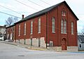
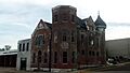
Eighth and Center Streets Baptist Church
-
Robert Elliott's Wholesale Grocery
-
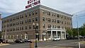
Federal Building
-
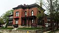
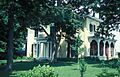
Gardner House
-
Green Double House
-
Hannibal Old Police Station and Jail
-
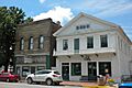
Hock Building
-
Benjamin Horr House
-
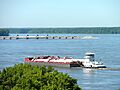
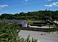
Lock and Dam No. 21 Historic District
-
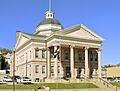
Marion County Courthouse
-
Marion County Jail and Jailor's House
-
Mark Twain Historic District
-
Mark Twain Hotel
-
Robert Masterson House
-
North Main Street Historic District
-
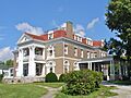
Rockcliffe Mansion
-
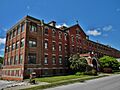
St. Elizabeth Hospital
-
Peter J. Sowers House
-
Speigle House
-
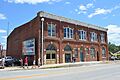
Standard Printing Company
-
Mark Twain Boyhood Home
-
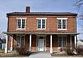
Walker-Woodward-Schaffer House


