National Register of Historic Places listings in Mineral County, Montana facts for kids
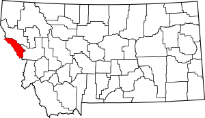
Have you ever wondered about old buildings and places that are really important to history? In Mineral County, Montana, there's a special list of these places! It's called the National Register of Historic Places. This list helps protect buildings, sites, and objects that tell us about the past. It's like a hall of fame for historic spots across the United States. Mineral County has 17 amazing places on this list.
Contents
What is the National Register of Historic Places?
The National Register of Historic Places is the official list of the nation's historic places worth saving. It's managed by the National Park Service. When a place is added to this list, it means it's important to local, state, or national history. This can be because of its architecture, its connection to important events, or its role in someone's life. Being on the list helps people understand and protect these special sites.
Historic Gems of Mineral County
Mineral County, Montana, is home to many fascinating historic sites. These places tell stories about the people who lived here and the events that shaped the area. Let's explore a few of them!
Alberton's Historic Buildings
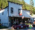
The town of Alberton has several buildings on the National Register. These include the Alberton School, built in 1916, which taught many generations of students. There's also Bestwick's Market, an old store that was a key part of the community. The Methodist Church of Alberton is another important site. It shows the history of faith and community gatherings in the town. Even the old Railroad Depot in Alberton is listed. It reminds us of the days when trains were the main way to travel and transport goods.
Railroad History
Railroads played a huge role in developing Montana. The Chicago, Milwaukee, St. Paul and Pacific Railroad Company Historic District is a large area that includes parts of an old railway line. This district is found in the Idaho Panhandle National Forest near St. Regis. It shows how important trains were for connecting communities and moving resources. Another cool spot is the Natural Pier Bridge near Alberton. This bridge was built in 1909 and is a great example of early engineering.
Old Schools and Mines
Beyond Alberton, other parts of Mineral County have historic treasures. The De Borgia Schoolhouse in De Borgia is a small, historic school building. It gives us a peek into how education happened in rural areas long ago. Near Superior, you can find the Gildersleeve Mine. This mine is located in the Lolo National Forest. It represents the important mining history of the region.
Scenic Bridges and Corridors
Two bridges in the county are also on the list. The Scenic Bridge near Tarkio crosses the Clark Fork River. It's a beautiful example of early 20th-century bridge design. The Point of Rocks Historic Transportation Corridor is a stretch of land west of Alberton. It shows how people and goods moved through this challenging landscape over time.
Savenac Nursery Historic District
Near Haugan, you'll find the Savenac Nursery Historic District. This nursery was very important for growing trees for reforestation efforts. It helped restore forests after logging and fires. It's a great example of early conservation work in the United States.
These are just a few of the 17 special places in Mineral County that are protected for future generations. They help us learn about the past and appreciate the history all around us!
Images for kids


