National Register of Historic Places listings in Mono County, California facts for kids
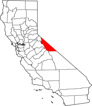
This page lists special places in Mono County, California, that are part of the National Register of Historic Places. This is a list of buildings, sites, and areas that are important to history. They are officially recognized by the United States government.
There are 5 places in Mono County on this list. One of them is extra special and is called a National Historic Landmark. These landmarks are very important to the history of the whole country.
Contents
Historic Places in Mono County
| Name on the Register | Image | Date listed | Location | City or town | Description | |
|---|---|---|---|---|---|---|
| 1 | Bodie Historic District |
(#66000213) |
7 miles (11 km) south of Bridgeport on U.S. Route 395, then 12 miles (19 km) east on secondary road 38°12′56″N 119°00′41″W / 38.215433°N 119.011503°W |
Bridgeport | ||
| 2 | Chalfant Petroglyph Site |
(#00001324) |
Address Restricted |
Bishop | ||
| 3 | Dry Lakes Plateau |
(#02001394) |
Address Restricted |
Bodie Hills | ||
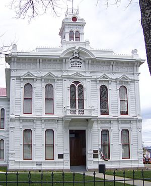
| 4 | Mono County Courthouse |
(#74000536) |
Main Street 38°15′22″N 119°13′39″W / 38.256111°N 119.2275°W |
Bridgeport | ||
| 5 | Yellow Jacket Petroglyphs |
(#00000321) |
Address Restricted |
Bishop |
What is the National Register of Historic Places?
The National Register of Historic Places is a list of special places in the United States. These places are important because of their history, architecture, or what they mean to a community. Being on this list helps protect these sites. It also helps people learn about the past.
Why are places listed?
Places are listed for many reasons. They might be where important events happened. They could be homes of famous people. Some are great examples of old buildings. Others might show how people lived long ago.
National Historic Landmarks
Some places are even more special. They are called National Historic Landmarks. These sites are very important to the history of the entire country. Mono County has one of these amazing landmarks.
Important Historic Sites in Mono County
Mono County is home to several fascinating historic sites. Each one tells a unique story about the area's past. Let's explore some of them.
Bodie Historic District
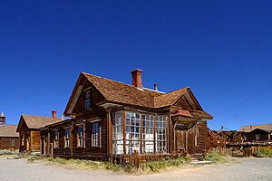
The Bodie Historic District is a famous ghost town. It is located about 7 miles south of Bridgeport. Bodie was once a busy gold mining town. Thousands of people lived there in the late 1800s.
Today, Bodie is a state historic park. It is kept in a state of "arrested decay." This means buildings are preserved as they were found. You can see old homes, stores, and even a church. It's like stepping back in time to the Gold Rush era. Bodie became a National Historic Landmark on October 15, 1966.
Chalfant Petroglyph Site
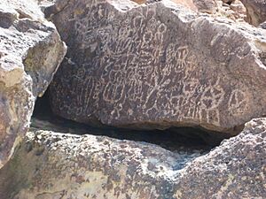
The Chalfant Petroglyph Site is a place with ancient rock art. Petroglyphs are pictures carved into rocks. These carvings were made by Native American people long ago. They tell stories or show important symbols.
This site is near Bishop. It was added to the National Register on November 21, 2000. Because these carvings are very old and delicate, the exact location is kept secret. This helps protect the art from damage.
Dry Lakes Plateau
The Dry Lakes Plateau is another historic district. It is located in the Bodie Hills. This area was added to the National Register on November 21, 2002. Like the petroglyph sites, its exact location is not shared. This helps protect its historical value.
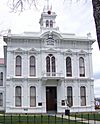
Mono County Courthouse
The Mono County Courthouse is an important building in Bridgeport. It is located on Main Street. This courthouse was built a long time ago. It has been used for many important decisions in the county.
The courthouse was added to the National Register on March 1, 1974. It is a great example of historic architecture. It shows how government buildings looked in the past.
Yellow Jacket Petroglyphs
The Yellow Jacket Petroglyphs are another site with ancient rock carvings. This site is also near Bishop. It was added to the National Register on April 6, 2000.
Like the Chalfant site, the location of the Yellow Jacket Petroglyphs is restricted. This is to keep these valuable historical artworks safe. These carvings give us clues about the lives of the first people in this area.


