National Register of Historic Places listings in Pemiscot County, Missouri facts for kids
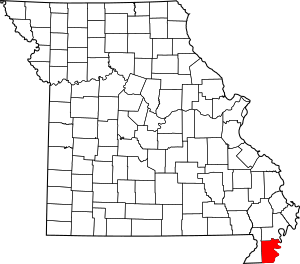
This article is about special places in Pemiscot County, Missouri that are listed on the National Register of Historic Places. Think of the National Register as an official list of buildings, sites, and objects that are important to the history of the United States. When a place is on this list, it means it's worth protecting and remembering for future generations.
In Pemiscot County, there are 8 different places that have earned a spot on this important list. These sites help us learn about the past, from ancient Native American villages to more recent structures that shaped the community.
Contents
What is the National Register of Historic Places?
The National Register of Historic Places is like a hall of fame for historical sites across America. It's managed by the National Park Service. Its main goal is to encourage people to save and appreciate places that tell a story about our country's past. These places might be old homes, schools, bridges, or even archeological sites where ancient people once lived.
Historic Places in Pemiscot County
Let's explore some of the fascinating places in Pemiscot County that are on the National Register. Each one has a unique story to tell!
Campbell Archeological Site
The Campbell Archeological Site is located near Cooter, Missouri. This site is very old and important because it shows us where Native American people lived a long, long time ago. Archeologists study places like this to understand how ancient cultures lived, what they ate, and how they built their communities. It's like a giant puzzle that helps us piece together history.
Caruthersville Water Tower
In the city of Caruthersville, Missouri, you can find the Caruthersville Water Tower on West 3rd Street. This isn't just any water tower; it's a historic landmark. Water towers are important parts of a city's infrastructure, helping to provide clean water to homes and businesses. This particular tower is recognized for its historical significance to the community.
Delmo Community Center
The Delmo Community Center is in Homestown, Missouri. This center played a big role in the community, especially during a time when people were working to improve living conditions and opportunities for everyone. Community centers often serve as gathering places for events, education, and support, and this one has a special place in history.
Delta Center Mound
The Delta Center Mound is an archeological site near Portageville, Missouri. Like the Campbell Site, this mound tells us about the ancient people who lived in this area. Archeological mounds are often burial sites or places where important community buildings once stood. They are like time capsules, preserving clues about past civilizations.
Denton Mound and Village Archeological Site
Near the community of Denton, there's another important archeological site called the Denton Mound and Village Archeological Site. This site includes both a mound and evidence of a village. It helps experts learn about the daily lives, homes, and customs of the Native Americans who lived there centuries ago.
Murphy Mound Archeological Site
About three miles southwest of Caruthersville, Missouri, you'll find the Murphy Mound Archeological Site. This is another significant location for understanding the ancient history of the region. Archeologists carefully dig and study these sites to uncover artifacts and structures that reveal how early inhabitants lived and interacted with their environment.
J.M. Wallace Archeological Site
The J.M. Wallace Archeological Site is located near Wardell, Missouri. This site is also protected because of its importance to understanding the ancient past of Pemiscot County. Archeological sites like this are non-renewable resources, meaning once they are disturbed or destroyed, their historical information is lost forever. That's why protecting them is so important.
United States Highway 61 Arch
The United States Highway 61 Arch is a unique structure found on U.S. Route 61 near Holland, Missouri. This arch is special because it marks the state line between Missouri and Arkansas. It's not just a road marker; it's a historic gateway that has welcomed travelers for many years. It's a great example of how even parts of our transportation system can become historical landmarks.
Images for kids


