
National Register of Historic Places listings in Providence County, Rhode Island facts for kids

Providence County, Rhode Island, is home to many amazing places that are listed on the National Register of Historic Places. This special list includes buildings, areas, and objects that are important to American history, architecture, archaeology, engineering, or culture. Think of it like a Hall of Fame for historic sites!
In Providence County, there are 434 places on this list. Fifteen of these are even more special and are called National Historic Landmarks. These landmarks are considered to be of national importance. Many of these historic spots are in the cities of Pawtucket, Woonsocket, and Providence. This article will tell you about some of the cool historic places found in the other towns and communities across Providence County.
Contents
Historic Places You Can Explore
Many of these places are old homes, mills, or even entire neighborhoods that show us what life was like long ago.
Cool Buildings and Homes
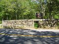
- 1761 Milestone: This old stone marker in Woonsocket (at 640 S. Main St.) is a reminder of how people used to mark distances on roads. It was added to the list on November 24, 1982.

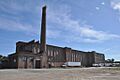
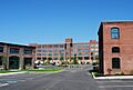
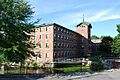
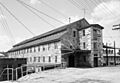
- Allendale Mill: Located at 494 Woonasquatucket Ave. in North Providence, this mill was listed on May 7, 1973. Mills like this were super important for making goods in the past.

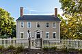
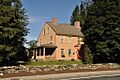
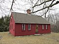
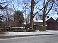
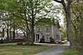
- Eleazer Arnold House: This house in Lincoln (on Great Rd.) is a National Historic Landmark! It was recognized on November 24, 1968, because it's a great example of an early American "stone-ender" house.

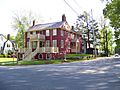
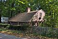
- Peleg Arnold Tavern: Found on Woonsocket Hill Rd. in North Smithfield, this old tavern was a popular stop for travelers. It was added to the list on July 30, 1974.

- Bicknell-Armington Lightning Splitter House: This unique house at 3591 Pawtucket Ave. in East Providence was listed on November 28, 1980. It has a special design meant to protect it from lightning!

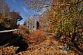
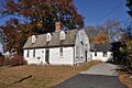
- Clemence-Irons House: Another very old house, located at 38 George Waterman Rd. in Johnston. It was listed on July 2, 1973, and shows us how people lived centuries ago.

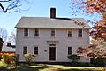
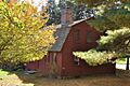
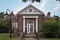
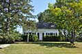
- Hearthside: This beautiful home on Great Rd. in Lincoln was listed on April 24, 1973. It's a great example of old New England architecture.

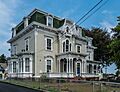
- Gov. William Sprague Mansion: Located at 1351 Cranston St. in Cranston, this mansion belonged to a former governor. It was listed on February 18, 1971.

Historic Districts and Villages
Some listings aren't just one building, but a whole area! These "historic districts" help preserve the look and feel of old communities.
- Albion Historic District: This area in Lincoln was listed on July 19, 1984. It includes many old buildings and streets that show the history of the Albion community.

- Arnold Mills Historic District: East of Cumberland Hill in Cumberland, this district was listed on December 28, 1978. It's a charming area with historic homes and buildings.

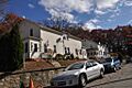
- Chepachet Village Historic District: This district in Glocester (along U.S. Route 44) was listed on March 31, 1971. It's a well-preserved village that looks much like it did in the past.

- Slatersville Historic District: In North Smithfield, this district (including Main, Green, Church, and School Sts.) was listed on April 24, 1973. It's one of the earliest planned mill villages in the United States.

Other Interesting Places
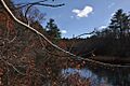
- Blackstone Canal: This long canal stretches through several towns, including Lincoln, Cumberland, Woonsocket, and North Smithfield. It was first listed on May 6, 1971, and was very important for transporting goods in the 1800s.

- Crescent Park Looff Carousel: Located in Riverside Park in East Providence, this beautiful carousel is a National Historic Landmark! It was built in 1895 and is known for its amazing craftsmanship. It was listed on April 21, 1976.

- Pomham Rocks Light Station: This lighthouse on Riverside Rd. in East Providence was listed on July 9, 1979. Lighthouses are important for guiding ships safely.

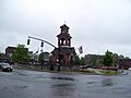
- Woonsocket Civil War Monument: Found in Monument Sq. in Woonsocket, this monument honors those who fought in the Civil War. It was listed on November 24, 1982.

- Second Battle of Nipsachuck Battlefield: This site in North Smithfield was added to the list on August 22, 2016. It's where an important battle took place during King Philip's War, a major conflict between Native Americans and English colonists in the 1670s.
Former Listing
Sometimes, a historic place can be removed from the National Register if it's destroyed or loses its historic importance.
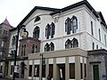
- Woonsocket Opera House: This building at 37-45 N. Main St. in Woonsocket was once listed on the National Register in 1973. Sadly, it was destroyed by a fire on September 22, 1975, and was later removed from the list.
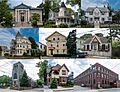
Images for kids
-
Allen Street Historic District
-
Allenville Mill Storehouse
-
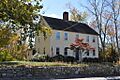
Andrews-Luther Farm
-
Daniel Angell House
-
Angell-Ballou House
-
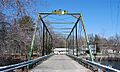
Arkwright Bridge
-
Dexter Arnold Farmstead
-
Israel Arnold House
-
John Arnold House
-
Ashton Historic District
-
Ballou House
-
Ballou-Weatherhead House
-
Battey-Barden House
-
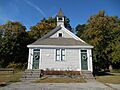
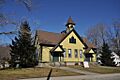
Belknap School
-
Berkeley Mill Village
-
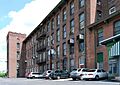
Bernon Worsted Mill
-
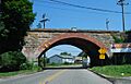
Boston and Providence Railroad Bridge
-
Borders Farm
-
Bridgeton School
-
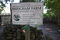
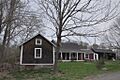
Bridgham Farm
-
Brown Avenue Historic District
-
Burlingame-Noon House
-
Carpenter, Lakeside, and Springvale Cemeteries
-
Cato Hill Historic District
-
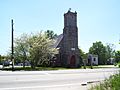
Central Falls Congregational Church
-
Central Falls Mill Historic District
-
Central Street School
-
Clayville Historic District
-
John Cole Farm
-
Samuel B. Conant House
-
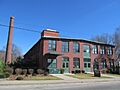
Conant Thread-Coats & Clark Mill Complex District
-
Amos Cooke House
-
Cornell-Randall-Bailey Roadhouse
-
Nathaniel Daggett House
-
Henry Darling House
-
James Dennis House
-
District 6 Schoolhouse
-
Capt. George Dorrance House
-
Eddy Homestead
-
Edgewood Historic District-Arnold Farm Plat
-
Edgewood Historic District-Taft Estate Plat
-
Edgewood Historic District-Shaw Plat
-
Edgewood Yacht Club
-
Elliot-Harris-Miner House
-
Elm Tree Plat Historic District
-

Esten-Bowen House
-
David G. Fales House
-
Edwin H. Farnum House
-
Thomas Fenner House
-
Forestdale Mill Village Historic District
-
Foster Center Historic District
-
French Worsted Company Mill Historic District
-
Furnace Carolina Site
-
Furnace Hill Brook Historic and Archeological District
-
Alphonse Gaulin Jr. House
-
Georgiaville Historic District
-
Glenark Mills
-
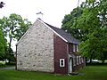
Glocester Town Pound
-
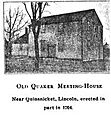
Great Road Historic District
-
Benjamin F. Greene House
-
Greystone Historic District
-
Greystone Mill Historic District
-
Grove Street Elementary School
-
Hanora Mills
-
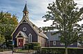
Harmony Chapel and Cemetery
-
Harris Warehouse
-
Harrisville Historic District
-
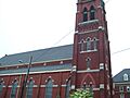
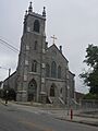
Holy Trinity Church Complex
-
Honan's Block and 112-114 Main Street
-
Hope Street School
-
Hope Village Historic District
-
Thomas H. Hughes House
-
Island Place Historic District
-
Jenckes House (Jenckes Hill Road)
-
Jenckes House (Old Louisquisset Pike)
-
Jenckes Mansion
-
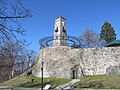
Jenks Park & Cogswell Tower
-
Luke Jillson House
-
Joy Homestead
-
Jules Desurmont Worsted Company Mill
-
Knightsville Meetinghouse
-
L'Eglise du Precieux Sang
-
Limerock Village Historic District
-
Lippitt Hill Historic District
-
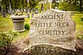
Little Neck Cemetery
-
Logee House
-
Lonsdale Historic District
-
Lymansville Company Mill
-
Main Street Historic District
-
Manton-Hunt-Farnum Farm
-
Manville Company Worker Housing Historic District
-
Mathewson Farm
-
Metcalf-Franklin Farm
-
Moosup Valley Historic District
-
Mt. Hygeia
-
Mount Vernon Tavern
-
Tyler Mowry House
-
William Mowry House
-
Newman Cemetery
-
Newman Congregational Church
-
Hopkins Mill Historic District
-
North End Historic District
-
Norwood Avenue Historic District
-
Oak Lawn Village Historic District
-
Oakland Historic District
-
Ochee Spring Quarry
-
Oddfellow's Hall
-
Old Ashton Historic District
-
Old Congregational Church
-
Capt. Stephen Olney House
-
Pascoag Grammar School
-
Patterson Brothers Commercial Building and House
-
Pawtuxet Village Historic District
-
Phillipsdale Historic District
-
Philmont Worsted Company Mill
-
Pocasset Worsted Company Mill
-
Pothier House
-
Pullen Corner School
-
Richmond Paper Company Mill Complex
-
Rosedale Apartments
-
Rose Land Park Plat Historic District
-
Rumford Chemical Works and Mill House Historic District
-
Rumford Historic District
-
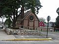
St. Andrews Episcopal Chapel
-
St. Ann's Church Complex
-
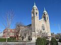
St. Charles Borromeo Church Complex
-

St. Joseph's Church Complex
-
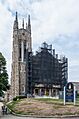
St. Mary's Episcopal Church
-
St. Matthew's Church
-
Saint Thomas Episcopal Church and Rectory
-
Sassafras Site, RI-55
-
Saylesville Meetinghouse
-
Sheldon House
-
Joseph Smith House
-
Smith-Appleby House
-
Smith-Ballou House
-
Smithfield Exchange Bank
-
Smithfield Friends Meeting House, Parsonage & Cemetery
-
Smithfield Road Historic District
-
Smithville Seminary
-
Smithville-North Scituate
-
South Central Falls Historic District
-
South Main Street Historic District
-
Squantum Association
-
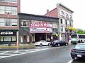
Stadium Building
-
Ira B. Sweet House
-
Moses Taft House
-
Three Dog Site, RI-151
-
Todd Farm
-
Lewis Tower House
-
U.S. Post Office (Woonsocket)
-
Union Village Historic District
-
Valley Falls Mill
-
Phillip Walker House
-
Waterman-Winsor Farm
-
Westcote
-
Nathan Westcott House
-
Whipple-Angell-Bennett House
-
Whipple-Cullen House and Barn
-
Whipple-Jenckes House
-
Whitcomb Farm
-
Frank Wilbur House
-

Stephen Winsor House
-
Arad Wood House
-
Woonasquatucket River Site (RI-163)
-
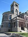
Woonsocket City Hall
-
Woonsocket Company Mill Complex
-
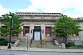
Woonsocket District Courthouse
-
Woonsocket Rubber Company Mill
-
World War I Memorial


