
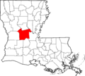
National Register of Historic Places listings in Rapides Parish, Louisiana facts for kids
This article is about the amazing historic places you can find in Rapides Parish, Louisiana. These special spots are listed on the National Register of Historic Places, which is like a national list of important buildings, sites, and objects that are worth protecting because of their history or unique design.
You can find 79 different places in Rapides Parish on this list. Some of these places are buildings, while others are entire areas called "historic districts." Six other places were once on the list but have since been removed.
This list helps everyone learn about and appreciate the rich history of Rapides Parish. You can even see where many of these places are on a map if their exact location details are shared.
Contents
- Historic Places You Can Visit
- Buildings and Homes with Stories
- Alexander State Forest Headquarters Building
- Alexandria Hall at Louisiana College
- Alexandria National Cemetery
- Alexandria Veterans Administration Hospital Historic District
- Bentley Hotel
- Bolton High School
- Arna Wendell Bontemps House
- Central Louisiana State Hospital Dairy Barn
- Commercial Building (Alexandria)
- Emmanuel Baptist Church
- First Methodist Church
- Fort Randolph
- Kent Plantation House
- Lecompte High School
- Masonic Building
- Mt. Olivet Episcopal Church and Cemetery
- Old Alexandria Public Library (Louisiana History Museum)
- Old LSU Site
- Rapides Bank and Trust Company Building
- Rapides Cemetery
- Rapides Parish Library
- Rose Cottage
- St. Francis Xavier Cathedral
- Trinity Episcopal Church
- US Post Office and Courthouse-Alexandria
- Historic Districts and Sites
- Buildings and Homes with Stories
- Other Notable Historic Places
- Images for kids
Historic Places You Can Visit
Many places in Rapides Parish are recognized for their special history. Let's explore some of them!
Buildings and Homes with Stories
Rapides Parish is home to many old buildings and houses that have been around for a long time and have interesting stories to tell.
Alexander State Forest Headquarters Building
This building is located in the Alexander State Forest near Woodworth. It was built by the Civilian Conservation Corps (CCC) in 1937, a group that helped people find jobs during the Great Depression by working on conservation projects. It's a great example of their work.

Alexandria Hall at Louisiana College
Found at Louisiana College in Pineville, Alexandria Hall is an important building on the college campus. It was added to the National Register in 1986.

Alexandria National Cemetery
This cemetery in Pineville is a quiet and respectful place where many soldiers from the Civil War and other conflicts are buried. It became a protected historic site in 1997.

Alexandria Veterans Administration Hospital Historic District
This area in Alexandria includes buildings that were part of a hospital for veterans. It was recognized in 1986 and later expanded to include more historic parts of the hospital.

Bentley Hotel
The Bentley Hotel, located on 3rd Street in Alexandria, is a grand old hotel that has been a landmark since it was built. It was added to the National Register in 1979.

Bolton High School
This school building at 2101 Vance Avenue in Alexandria has been an important part of the community for many years. It was listed as a historic place in 1984.

Arna Wendell Bontemps House
This house at 1327 3rd Street in Alexandria was once the home of Arna Wendell Bontemps, a famous writer and poet. It was recognized for its historical importance in 1993.

Central Louisiana State Hospital Dairy Barn
This dairy barn, located on U.S. Route 165 in Pineville, is a unique historic structure. It was part of the Central Louisiana State Hospital and was listed in 1986.

Commercial Building (Alexandria)
This building at 3rd and Johnston Streets in Alexandria is a historic commercial building. It was added to the National Register in 1978.

Emmanuel Baptist Church
Located at 430 Jackson Street in Alexandria, this church is a significant religious building. It was listed as a historic place in 2001.

First Methodist Church
This church at 630 Jackson Street in Alexandria was recognized for its history in 1980. It's an important part of the city's religious heritage.
.JPG)
Fort Randolph
Near U.S. Route 165 in Pineville, Fort Randolph is a historic site that played a role in the Civil War. It was listed in 1981.

Kent Plantation House
Located west of Alexandria on Bayou Rapides, the Kent Plantation House is one of the oldest standing structures in Louisiana. It offers a glimpse into life on a plantation and was listed in 1971.

Lecompte High School
This school building at 1610 Charter Street in Lecompte has a long history in the community. It was added to the National Register in 1992.

Masonic Building
Found at 4th and Johnston Streets in Alexandria, the Masonic Building is a historic structure that was listed in 1986.
.JPG)
Mt. Olivet Episcopal Church and Cemetery
This church and its cemetery at 335 Main Street in Pineville are historic sites. They were recognized in 2000 for their importance to the area's history.

Old Alexandria Public Library (Louisiana History Museum)
This building at 503 Washington Street in Alexandria once served as the public library and is now the Louisiana History Museum. It was listed in 1989.

Old LSU Site
North of Pineville, at 2500 Shreveport Highway, is the site where the original Louisiana State University was located. This important educational site was listed in 1973.

Rapides Bank and Trust Company Building
This building at 933 Main Street in Alexandria is a historic bank building. It was added to the National Register in 1980.

Rapides Cemetery
Located at Hardtner and Main Streets in Pineville, Rapides Cemetery is a historic burial ground. It was listed in 1979.

Rapides Parish Library
The main branch of the Rapides Parish Library at 411 Washington Street in Alexandria is a historic building. It was recognized in 2016.

Rose Cottage
This charming cottage on Azalea Street in Pineville is a historic home. It was listed in 1983.

St. Francis Xavier Cathedral
Located at 626 4th Street in Alexandria, this cathedral is a beautiful and historic church. It was added to the National Register in 1980.

Trinity Episcopal Church
This church, located on Bayou Rapides in Cheneyville, is a historic Episcopal church. It was listed in 1980.

US Post Office and Courthouse-Alexandria
This building at 515 Murray Street in Alexandria served as a post office and courthouse. It was recognized for its historical significance in 2000.
_Alexandria_(Rapides_Parish,_Louisiana).jpg)
Historic Districts and Sites
Some listings on the National Register cover larger areas or specific sites that are important.
Alexandria Garden District
This historic district in Alexandria is a neighborhood roughly bounded by Marye Street, Bolton Avenue, White Street, and Bayou Hynson. It's known for its beautiful homes and gardens and was listed in 2001.

Alexandria Post-War Suburbs Historic District
This district in Alexandria includes neighborhoods built after World War II. It shows how the city grew and changed during that time and was listed in 2013.

Bailey's Dam Site
This site on the Red River south of U.S. Route 71 in Alexandria is where Bailey's Dam was located. This dam was important during the Civil War and was listed in 1976.

Crowell Sawmill Historic District
This historic district at 11789 U.S. Route 165 South in Longleaf includes the old Crowell Sawmill. It tells the story of the timber industry in Louisiana and was listed in 1993.
Inglewood Plantation Historic District
This district, located off U.S. Route 71 in Alexandria, includes the historic Inglewood Plantation. It was recognized in 1988.
McNutt Rural Historic District
This rural historic district near McNutt includes Belgard Bend Road and Louisiana Highway 121. It shows what rural life was like in the past and was listed in 1988.
Lamourie Lock
Located at the junction of Lamourie Road and U.S. Route 71 in Lecompte, the Lamourie Lock is a historic engineering site. It was listed in 1994.
Other Notable Historic Places
Many other individual properties are also listed on the National Register, each with its own unique history.
- Bayouside, north of McNutt off Louisiana Highway 121, listed in 1980.
- Bennett Plantation House, 6291 Old Baton Rouge Highway, Alexandria, listed in 1979.
- Blanchard House, west of Boyce on Bayou Jean de Jean, Boyce, listed in 1982.
- Bland House, 330 Saint James Street, Alexandria, listed in 1985.
- James Wade Bolton House, 1330 Main Street, Alexandria, listed in 1979.
- Boyce Methodist Church, 309 Londonderry Avenue, Boyce, listed in 2013.
- Britt Place, east of Glenmora on Lake Cocodrie Road, listed in 1980.
- J.E. Byram House, 915 City Park Boulevard, Alexandria, listed in 2016.
- Carnahan House, 212 Ulster Avenue, Boyce, listed in 1995.
- Chickama, 687 Chickamaw Road, Lecompte, listed in 2016.
- China Grove, on Louisiana Highway 496 in Gardner, listed in 1984.
- Cook House, 222 Florence Avenue, Alexandria, listed in 1979.
- Cottingham House, 1403 College Drive, Pineville, listed in 1987.
- Myrtle Groves Huie Dellmon House, 430 St. James Street, Alexandria, listed in 2017.
- Eden, off Louisiana Highway 121 in Gardner, listed in 1984.
- First United Methodist Church, 2727 Jackson Avenue, Alexandria, listed in 2015.
- Fort Buhlow, off U.S. Route 165 in Pineville, listed in 1981.
- Gemiluth Chassodim Synagogue, 2021 Turner Street, Alexandria, listed in 2014.
- Geneva, on Louisiana Highway 496 in Alexandria, listed in 1984.
- Guaranty Bank, Park Avenue Branch, 403 Bolton Avenue, Alexandria, listed in 2013.
- Hemenway Furniture Co. Building, 3rd and Jackson Streets, Alexandria, listed in 1983.
- Mayer Hirsch House, 1216 Jackson Street, Alexandria, listed in 1979.
- Hope, off Louisiana Highway 121 and Mill Race Road in Gardner, listed in 1984.
- Island Home, across Bayou Rapides off Louisiana Highway 121 in Gardner, listed in 1984.
- Wade H. Jones, Sr., House, Meeker Road, Meeker, listed in 1987.
- Huey P. Long Memorial Hospital, 352 Hospital Boulevard, Pineville, listed in 2015.
- Longview, across Bayou Rapides from Louisiana Highway 121 near its intersection with Louisiana Highway 1200 in Gardner, listed in 1984.
- Loyd Hall Plantation, northwest of Cheneyville on Loyd Bridge Road, listed in 1977.
- Masonic Home for Children, 2145 Horseshoe Drive, Alexandria, listed in 1987.
- Dr. Robert E. McGill House, 2704 Hill Street, Alexandria, listed in 2000.
- McNutt School, 720 Millrace Road, Boyce, listed in 1997.
- Meeker Sugar Refinery, on U.S. Route 71 in Meeker, listed in 1987.
- Melady House, 5800 England Drive, Alexandria, listed in 1996.
- Myrtlewood, 2301 Military Highway, Pineville, listed in 2012.
- Pegram Plantation House, 881 Chickamaw Road, Lecompte, listed in 2003.
- Rosalie Plantation Sugar Mill, south of Alexandria off U.S. Route 71, listed in 1976.
- Rugg Elementary School, 1319 Bush Avenue, Alexandria, listed in 2001.
- St. John Baptist Church, off Louisiana Highway 456 in Lecompte, listed in 1982.
- St. Philip's Episcopal Church, 414 Clare Street, Boyce, listed in 2012.
- C.A. Schnack Jewelry Company Store, 924 3rd Street, Alexandria, listed in 2000.
- Tioga Commissary, Tioga Road, Tioga, listed in 1986.
- Morgan Walker House, 2400 Horseshoe Drive, Alexandria, listed in 1987.
- Walnut Grove, east of Cheneyville, listed in 1980.
- Welcek Farmstead, on Louisiana Highway 107 in Kolin, listed in 1985.
Images for kids
-
Location of Rapides Parish in Louisiana

