National Register of Historic Places listings in Robertson County, Tennessee facts for kids
Have you ever wondered about the old buildings and places in your town? Many special spots in the United States are protected because they are important to history. This list tells you about the historic places in Robertson County, Tennessee, that are part of the National Register of Historic Places.
The National Register of Historic Places is like a special list of buildings, sites, and objects that are important to the history of the United States. When a place is on this list, it means it's recognized for its historical, architectural, or archaeological value. It helps protect these places for future generations to learn from and enjoy. In Robertson County, Tennessee, there are 28 places on this important list.
Contents
Exploring Robertson County's History
Robertson County is full of interesting stories and old places. Let's explore some of the most famous and unique spots that are protected because of their history.
Places with Spooky Stories
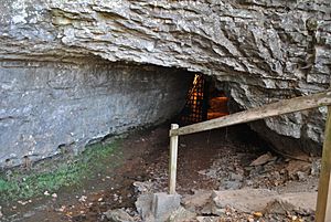
The Bell Witch Cave
One of the most famous and mysterious places in Robertson County is the Bell Witch Cave in Adams, Tennessee. This cave is linked to the legend of the Bell Witch, a ghost story that has been told for generations. People say a spirit haunted the Bell family in the early 1800s. The cave is a popular spot for those interested in local legends and spooky tales. It was added to the National Register in 2008.
Important Old Buildings
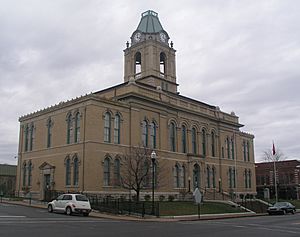
Robertson County Courthouse
The Robertson County Courthouse is a very important building in Springfield, Tennessee. It stands in the Public Square and has been a center of local government for many years. Courthouses are often the heart of a county, where important decisions are made and history unfolds. This courthouse was recognized for its historical value in 1978.
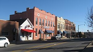
Springfield Town Square Historic District
The area around the courthouse, known as the Springfield Town Square Historic District, is also on the National Register. This district includes many old buildings that show what the town looked like long ago. It's a great example of a traditional American town square, where people gathered for business and community events. This district was added to the list in 1979.
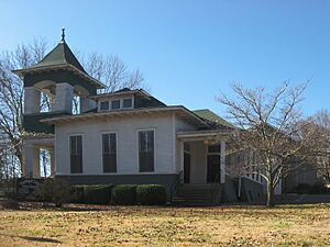
Highland Chapel Union Church
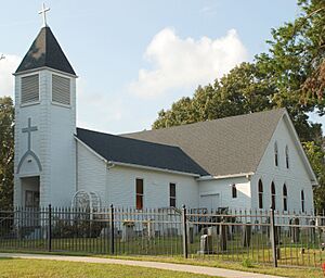
The Highland Chapel Union Church in Ridgetop, Tennessee, is another historic site. Churches often play a big role in the community's history, serving as places of worship and gathering spots for many years. This church was listed in 1991, showing its importance to the local community's heritage.
St. Michael's Catholic Church
In Cedar Hill, Tennessee, you can find St. Michael's Catholic Church. This church has been a significant part of the community's religious and social life for a long time. It was added to the National Register in 1973, recognizing its historical and architectural importance.
Thomas Drugs
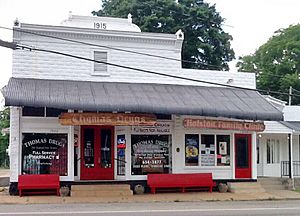
Thomas Drugs in Cross Plains, Tennessee, is a unique historic place. It's not just a building; it's a piece of history that shows what old-time drugstores were like. Places like this often served as community hubs where people could get medicines, snacks, and catch up on local news. It was listed in 1993.
Historic Homes and Farms
Many old homes and farms in Robertson County tell stories of the past. These places show how people lived, worked, and built their lives over generations.
Wessyngton
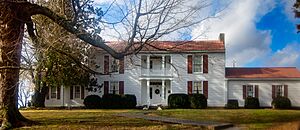
Wessyngton in Cedar Hill, Tennessee, is a very important historic estate. It's a large property with a rich history, showing what life was like on a big farm in the past. It was one of the earliest places in Robertson County to be added to the National Register, back in 1971.
The Beeches
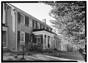
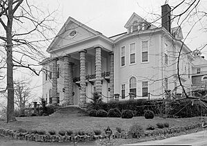
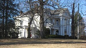
"The Beeches" is a beautiful historic home located in Springfield, Tennessee. This house, found on State Route 49, was added to the National Register in 1982. It represents the architectural styles and way of life from a different era.
Cornsilk
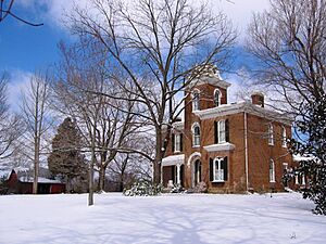
In Cross Plains, Tennessee, you can find "Cornsilk," another historic home. Located on Stringer Road, this property was listed in 1974. It's a great example of the older homes that dot the landscape of Robertson County.
Glen Raven
"Glen Raven" is a historic house in Cedar Hill, Tennessee. It was added to the National Register in 1973. These old homes help us understand the history of families and communities in the area.
Mollie and Neel Glenn House
The Mollie and Neel Glenn House in Springfield, Tennessee, is a historic residence listed in 2012. It's a more recent addition to the National Register, showing that even homes from the early to mid-20th century can be historically significant.
Mansfield Cheatham House
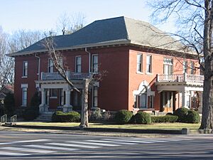
The Mansfield Cheatham House, also in Springfield, Tennessee, was added to the National Register in 1978. It's another example of the beautiful and historically important homes in the county.
William Randolph House
The William Randolph House in Cross Plains, Tennessee, is a historic home that was listed in 1973. It's one of many old farmhouses and estates that tell the story of early settlers and their lives in the region.
Walton–Wiggins Farm
The Walton–Wiggins Farm in Springfield, Tennessee, is a historic farm property. Farms are important because they show how people lived off the land and contributed to the economy of the past. This farm was added to the National Register in 1997.
Woodard Hall
Woodard Hall, located in Springfield, Tennessee, is another significant historic property. It was listed in 1975, and later, its boundaries were expanded in 1995 to include more of the historic land.
Other Cool Places
Nelson's Green Brier Distillery
In Greenbrier, Tennessee, you can find the site of Nelson's Green Brier Distillery. Distilleries played a role in the economy and history of many Southern states. This site was added to the National Register in 2008.
Red River Blockhouse Number 1
The Red River Blockhouse Number 1, near Adams, Tennessee, is a historic site that was listed in 2003. Blockhouses were often small forts or defensive structures used in earlier times, especially during conflicts or for protection on the frontier.
Images for kids
See also


